 Wendy says that Cathy Cannon (who does the Nature at Night classes for COM) is the naturalist leading paddles this summer at Sunset Bay Kayaks and asks if anyone is up for a meander to Suisun? It would be fun to do it together. Cathy says experience is not required. (E-mail Wendy if you're interested).
Saturday, May 31, 2008
Up A Lazy River?
Wendy says that Cathy Cannon (who does the Nature at Night classes for COM) is the naturalist leading paddles this summer at Sunset Bay Kayaks and asks if anyone is up for a meander to Suisun? It would be fun to do it together. Cathy says experience is not required. (E-mail Wendy if you're interested).Finding Information On A Specific Hike
You remember we hiked on Mount Burdell, but have forgotten which trails we took and what we saw? No problem --- just type "Burdell" into the "Search" box at the top left-hand corner of this blog and you'll find all of the blog "posts" on that topic including the directions to the trailhead, the map and hike directions from the trailguides which Dick posted, and Wendy's "What Did We See" recaps. (This "How To Search This Blog" tip is also on the right-hand side of the blog right below the photo "slideshow" and the list of upcoming hikes.
This same "Search" feature can be used to find all of the "posts" related to any topic. So if you mislaid the recipe for the Lavender-Blueberry soup that Dick made for the Spring 2008 "Final Exam" lunch, just type "soup" into the "Search" box and you'll find it!
Trail Guides for Hiking in Marin
Tracy Salcedo-Chourre's book Exploring Point Reyes National Seashore and Golden Gate National Recreation Area (The Globe Pequot Press, 2003) is another trail guide which you might find useful and, like the Martin's book, is also available through Book Passage in Corte Madera.
Finally, Barry Spitz' book Open Spaces: Lands of the Marin County Open Space District, covering trails on these public lands, can be purchased through Amazon. com.
Laguna Trailhead Hike (June 3) Preview
For the third week in a row, we'll be head out to West Marin. This 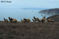 time we'll hike in the the Limantour area of the Point Reyes National Seashore. Here's Wendy's description of the outing: "Today we explore four habitats: coastal scrub, beach, marsh, and a riparian (streamside) habitat with alders and willows. Lunch at the beach. We may see some of the tule elk that have been transferred from Tomales Point."
 time we'll hike in the the Limantour area of the Point Reyes National Seashore. Here's Wendy's description of the outing: "Today we explore four habitats: coastal scrub, beach, marsh, and a riparian (streamside) habitat with alders and willows. Lunch at the beach. We may see some of the tule elk that have been transferred from Tomales Point."
 Here are the directions to the trailhead (carpool leaves St. Rita at 8:50):
Take Sir Francis Drake Blvd. west to Olema. Turn right on Rt.1, then make an immediate left onto Bear Valley Rd. Continue past Park Headquarters (turn in if you need a restroom) and go left on Limantour Rd. Turn left at the sign for the youth hos-tel. Follow that road until you see a right turn across a bridge to the Laguna Trailhead by the Clem Miller Education Center. Park in the parking lot. No restrooms at trailhead. Restrooms en route before lunch.
Although the Martin's book, Hiking Marin, shows three hikes in this general area of the seashore, none appear to follow the route we're likely to take. The "Laguna-Coast Trail Loop" hike in Exploring Point Reyes Seashore and Golden Gate National Recreation Area (Salcedo-Chourre, A Falcon Guidebook by The Globe Pequot Press, 2003) shows our probable path:
(Click here to view and print out the hike details and map from the Salcedo-Chourre book. If you have Adobe Acrobat Reader on your computer you can print the document. Once you see the document on the "Scribd" Web site, click on the "Download" icon and then on the "PDF" icon to open the document on your computer).
Thursday, May 29, 2008
New! Bear Valley to Five Brooks Hike Photos On-Line!
 Dick shot lots and lots and lots of photos on our hike from Bear Valley to Five Brooks on Tuesday, May 27th. After "Photoshopping" them, he uploaded around fifty new photos which appear in both the slideshow window in the "Meandering in Marin on Tuesdays" blog and in the on-line album of photos from all our recent hikes.
Wednesday, May 28, 2008
Bear Valley to Five Brooks --- A Hike With Only One "Fault"
A perfect trail (not too flat, not too well traveled, not too steep). Perfect weather (not too hot, not too cold, not too much sun, not too cloudy, and 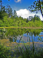 no rain). Perfect companions (although only about half of our regular Tuesday group, plus Stan from the Monday "Meanderers", made this hike). Our slightly uphill trek from Bear Valley to Five Brooks in the Point Reyes National Seashore was a perfectly delightful outing.
We started off with a short stroll to the pond at Five Brooks. The Wood Ducks wouldn't show, but we did spot some "UFDs" (Unidentified Floating Ducks) during our "circumnavigation" of this small "lake". As we had on the Rock Springs hike two weeks earlier, we met up with another contingent of regular Tuesday "geezer" hikers --- this group hailed from Inverness and we wished each other a good day on the trail as we parted company.
Back at the parking lot, we ran into a large contingent of teenagers who had spilled out of several tour buses and were awaiting assignment to clean up trails in this section of the park. We left them to their chores and hopped back into our cars to shuttle north up Highway 1 past Olema to park headquarters where our hike southward back to Five Brooks would begin.
Our hike's route through the earthquake "rift zone" paralleled the San Andreas Fault which splits the Olema Valley roughly down its middle. Luckily for us, the National Weather Service forecast of cool temperatures (in the high 50's) proved erroneous and the fog failed to push over the ridge of coastal hills and into the valley. As we started out from near the park's visitor center in Bear Valley, the overcast of the past few days was replaced by sunny skies dotted with puffy white cumulus clouds signaling warming into the mid-60's --- "Goldilocks Hiking Weather."
The first section of our hike through the area adjacent to Bear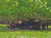 Valley took us through a large, grassy meadow bounded to the north by a long line of Cypress trees marking the entrance to the 2,000 acre parcel owned by the Vedanta Society of Northern California. We encountered a small herd of Black Angus cattle loafing under a tree as we began our trek across this Hindu-based organization's land putting us squarely on the horns of a dilemma: Were these "Sacred Cows" whose lives would be lived out to a "natural" end in the pasture, or were they being raised to provide protein-on-the-hoof for the omnivores in our group? A loading chute on the far side of the meadow ominously implied that a trip to the slaughter house was in their future. We took a short break here while Wendy related the history of the Society and its ownership of this property within the Point Reyes National Seashore boundaries.
From that point on the trail climbed upward in occasionally steep spurts, taking us from shady forests into open meadows and back again. This alternating habitat created opportunities to hear or see many birds, including flycatchers, a winter wren, hawks and Turkey Vultures, as well as baby turkeys and quail. A little past mid-day we found an ideal picnic spot on a grassy slope with a view back to the forested ridgeline to the west.
About three hours into the hike we passed more Black Angus in a small meadow, then during a fairly precipitous decent to the valley floor just behind the historic Stewart Ranch we were treated to a cacophonous "serenade" by unseen cows whose bellowing voices conjured up visions of them being carved into rib-eye steaks without the benefit of sedation. A short time later we crossed a stream and entered the Stewart Horse Camp where we stopped for a bit while Wendy recounted the names of some of the pioneer families (including the Stewarts) that had settled this part of Marin County. (The Stewarts also ranched in Nicasio and are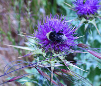 mentioned in Nicasio: The Historic Valley At The Center of Marin, a book recently published by and available through the Nicasio Historical Society.)
Less than half a mile later the trail brought us back to the pond at Five Brooks where we had started the day. Wendy made her "first ever" sighting of a Muskrat cruising across this pond. Damsel and dragonflies zipped back and forth along its perimeter. The tour buses were still in the parking lot, but we never saw the teenagers whose trail work apparently had taken them off in directions away from the path which we had followed. We ended the day with a 15-20 minute drive back to Bear Valley, retracing the route that had taken us ten times as long to hike.
 no rain). Perfect companions (although only about half of our regular Tuesday group, plus Stan from the Monday "Meanderers", made this hike). Our slightly uphill trek from Bear Valley to Five Brooks in the Point Reyes National Seashore was a perfectly delightful outing.
We started off with a short stroll to the pond at Five Brooks. The Wood Ducks wouldn't show, but we did spot some "UFDs" (Unidentified Floating Ducks) during our "circumnavigation" of this small "lake". As we had on the Rock Springs hike two weeks earlier, we met up with another contingent of regular Tuesday "geezer" hikers --- this group hailed from Inverness and we wished each other a good day on the trail as we parted company.
Back at the parking lot, we ran into a large contingent of teenagers who had spilled out of several tour buses and were awaiting assignment to clean up trails in this section of the park. We left
 them to their chores and hopped back into our cars to shuttle north up Highway 1 past Olema to park headquarters where our hike southward back to Five Brooks would begin.
Our hike's route through the earthquake "rift zone" paralleled the San Andreas Fault which splits the Olema Valley roughly down its middle. Luckily for us, the National Weather Service forecast of cool temperatures (in the high 50's) proved erroneous and the fog failed to push over the ridge of coastal hills and into the valley. As we started out from near the park's visitor center in Bear Valley, the overcast of the past few days was replaced by sunny skies dotted with puffy white cumulus clouds signaling warming into the mid-60's --- "Goldilocks Hiking Weather."
The first section of our hike through the area adjacent to Bear
 Valley took us through a large, grassy meadow bounded to the north by a long line of Cypress trees marking the entrance to the 2,000 acre parcel owned by the Vedanta Society of Northern California. We encountered a small herd of Black Angus cattle loafing under a tree as we began our trek across this Hindu-based organization's land putting us squarely on the horns of a dilemma: Were these "Sacred Cows" whose lives would be lived out to a "natural" end in the pasture, or were they being raised to provide protein-on-the-hoof for the omnivores in our group? A loading chute on the far side of the meadow ominously implied that a trip to the slaughter house was in their future. We took a short break here while Wendy related the history of the Society and its ownership of this property within the Point Reyes National Seashore boundaries.
From that point on the trail climbed upward in occasionally steep spurts, taking us from shady forests into open meadows and back again. This alternating habitat created opportunities to hear or see many birds, including flycatchers, a
 winter wren, hawks and Turkey Vultures, as well as baby turkeys and quail. A little past mid-day we found an ideal picnic spot on a grassy slope with a view back to the forested ridgeline to the west.
About three hours into the hike we passed more Black Angus in a small meadow, then during a fairly precipitous decent to the valley floor just behind the historic Stewart Ranch we were treated to a cacophonous "serenade" by unseen cows whose bellowing voices conjured up visions of them being carved into rib-eye steaks without the benefit of sedation. A short time later we crossed a stream and entered the Stewart Horse Camp where we stopped for a bit while Wendy recounted the names of some of the pioneer families (including the Stewarts) that had settled this part of Marin County. (The Stewarts also ranched in Nicasio and are
 mentioned in Nicasio: The Historic Valley At The Center of Marin, a book recently published by and available through the Nicasio Historical Society.)
Less than half a mile later the trail brought us back to the pond at Five Brooks where we had started the day. Wendy made her "first ever" sighting of a Muskrat cruising across this pond. Damsel and dragonflies zipped back and forth along its perimeter. The tour buses were still in the parking lot, but we never saw the teenagers whose trail work apparently had taken them off in directions away from the path which we had followed. We ended the day with a 15-20 minute drive back to Bear Valley, retracing the route that had taken us ten times as long to hike.
Monday, May 26, 2008
What We Saw On The Tomales Bay Hike
Here's Wendy's list of what we saw while hiking in Tomales Bay State Park on May 13th:
OTHER PLANTS
FUNGI
BIRDS
MISC
NATIVE AMERICAN FOOD SOURCES
Nuts: hazel (already on tree), bay, live oak, chinquapin
Berries: gooseberry (in fruit), salal (in flower), dewberry (native blackberry, some unripe berries), thimbleberry (some flowers, some unripe berries), huckleberry (some flowers, some unripe berries), salmonberry (in flower), manzanita (ripe berries)
Berries to be: toyon, madrone
PLANTS WITH OTHER USES
Medicine: coffeeberry (laxative), poison oak (wart removal), ocean spray (blossoms used for diarrhea, infusion of inner bark used as an eyewash, poultice of leaves applied to sore lips or feet.) Note: ocean spray uses are other tribes, not Miwok.
Salal: chew young leaves when lost in the woods to quell hunger (assuming no ripe berries for your hunger!), leaves to flavor fish, eaten by both husband and wife when newly wed for male first born child.
Baldness cure: ground seeds of coastal manroot (oval fruit instead of round fruit) mixed with skunk grease
Ledum (aka Labrador tea) It was used as a tea for colds and sore throats, but contains toxic alkaloids and is poisonous to sheep and other livestock. “It is said to be relaxing, and for some people to cause drowsiness, possible due to the potentially toxic glycosides present in the leaves. Others feel no such effects from it. Should be used in moderation. Excessive doses act as a strong diuretic or cathartic.”
Hunger suppressant: young deer fern leaves
Music: elderberry for clappers and flutes
Dye: alder bark
Pitch to seal baskets: Bishop pine
Fiber for basketry: chain fern (used in conjunction with other fibers)
FERNS
Deer fern (we saw sterile fronds which are perrenial and fertile ones which look like fish skeletons and are desciduous), bracken, chain fern, sword fern, lady fern
OTHER PLANTS
hedge nettle (for cordage), pickleweed, cord grass (lowest tide zone), goosefoot (triangular leaves, same family as quinoa, host plant for pygmy blue butterfly), dodder in flower (parasite on pickleweed), Siberian candyflower, one spotted coralroot without spots (immaculata instead of maculata), Ceanothus (full bloom!), toyon (real tree, not shrubby) CALIFORNIA BOTTLEBRUSH GRASS (“plant of limited distribution” a step better than threatened.)
FUNGI
Oyster mushrooms! Artist’s conk (always on bay, produces 350,000 spores per second!!!!)
BIRDS
Osprey (3 nests! Lots of calling!), red-tailed hawk, American robin, Stellar’s jay, spotted towhee (heard “coach’s whistle)
Heard: Wilson’s warbler, song sparrow (usually 3 introductory notes), Swainson’s thrush, wrentits (bouncing ball), hairy woodpecker (dog’s squeaky toy), winter wren (long song with circular breathing), warbling vireo (often ends warbler with a question, on an up note), Pacific slope flycatcher (chee-weep) Heard lots of ospreys!
MISC
RAYS We have at least three skates and five rays in this area, but most likely we saw bat rays that “seek out inshore bays and sloughs…where they dig and flap their wings to uncover the worms, shrimps, clams, abalone, and crabs that they feed on.” They are found from shore to 150’ depth and occur in aggregations. “Stinger and powerful crushing jaws are potentially dangerous.” So I was wrong about the stinger – I only remembered the crushing jaws.
Banana slug
Black-tailed deer
(Click here if you want to view and print a copy of this list. If you have Adobe Acrobat Reader on your computer you can print the document. Once you see the document on the "Scribd" Web site, click on the "Download" icon and then on the "PDF" icon to open the document on your computer).
Weather Forecast for Bear Valley to Five Brooks Hike
 Hopefully it didn't rain on your (Memorial Day) parade this weekend. We should have spring like conditions (it is still spring for another three weeks or so) for our hike on Tuesday, May 27th, from Bear Valley to Five Brooks in the Point Reyes National Seashore.
The National Weather Service says (as of Monday, May 28th, at 8:09 a.m.) that we can expect mostly cloudy skies, with a high near 59, and calm winds becoming west between 8 and 11 mph. (Click here for an updated forecast).
Saturday, May 24, 2008
Bear Valley to Five Brooks (May 27th) Hike Preview
 On Tuesday, May 27th, we'll once again be hiking in Point Reyes National Seashore, this time from Bear Valley to Five Brooks. (This hike involves a car shuttle, so please be sure to e-mail Wendy before Tuesday if you plan on going).
Here's Wendy's description of the outing, along with directions for carpooling (or driving directly to Five Brooks where we'll meet to begin the trip):
Meet at Five Brooks at 9:30 am. We’ll do a loop of the pond to check on dragonflies like the Western pondhawk and the 8-spotted skimmer, and possible wood ducks. At 9:50 am we’ll carpool to Bear Valley. We end up back at Five Brooks. We could see four species of swallows on this hike.
Carpool leaves St. Rita at 8:40 am. Take Sir Francis Drake Blvd to Olema and turn south (left). Turn right at sign marked Five Brooks onto short dirt road to the parking lot. Restrooms at Bear Valley, outhouses at Five Brooks.
The Martin's book, Hiking in Marin, has a similar "car shuttle" hike, but theirs runs from Five Brooks to Bear Valley --- just the opposite direction for our hike.
(Click here to view and print out the hike details and map from the Martin book. If you have Adobe Acrobat Reader on your computer you can print the document. Once you see the document on the "Scribd" Web site, click on the "Download" icon and then on the "PDF" icon to open the document on your computer).
Friday, May 23, 2008
Tomales Bay State Park Hike (May 20) Photos
 Neither Dick Jordan nor Theresa Fisher were on our Tomales Bay State Park hike on Tuesday, May 20 to take pictures. (If you took the hike and have pictures to share, e-mail them to Dick: rhjordan@earthlink.net). But if you click here, you can view photos of the park from the "Bay Area Hiker" Web site
Tuesday, May 20, 2008
What YOU Did On Your Summer Vacation
 It's almost summer (well, last week it felt like summer in Death Valley here in Marin, didn't it?), a time when many of our Tuesday Meandering members (and even our Fearless Leader, Wendy) will be taking a break from our weekly hikes to meander outside of Marin.
We'll miss you when you're gone traveling hither and yon, BUT you can stay in touch with us by contributing your travel stories (and pictures) to the brand new "Meandering Outside of Marin" blog (hey, if one blog is good, two would be even better, yes?) that Dick is putting together just so you can share your road trip adventures (and misadventures) with those of us who will be staying here at home chasing Wendy over hill and dale.
Soon you'll receive an invite from the new blog to be an author (not just a reader) and in a few days Dick will be giving you simple directions on how to post your stories via e-mail either during (or before and after) your vacation trip.
Sunday, May 18, 2008
New! Improved Hike Photo Album and Slideshow
 The "slideshow" of our hike photos located at the top, right-hand side of the "Meandering" blog has been revised. Now it only shows photos from the last hike, so you don't have to wait for the slideshow to run all the way to the end to see the latest photos.
The slideshow window has been moved higher up on the page, and made a little larger, to make viewing the photos easier.
Photos from all of the past hikes (including the last one we took) are still in the "Meandering in Marin on Tuesdays" on-line Picasa Web album. (To access that album, just click on the words "On Line Album of All Hike Photos (Click Here)" right below the slideshow window.
Weather Forecast for the Tomales Bay Hike
 Here is what the National Weather Service is predicting (as of 9:05 am on Sunday, May 18th) for the general area around Tomales Bay State Park on Tuesday, May 20th:
Patchy fog before 11 am. Otherwise, mostly sunny, with a high near 63. Breezy, with a west northwest wind between 16 and 25 mph, with gusts as high as 31 mph.
(Click here to got an updated forecast from the National Weather Service).
Tomales Bay State Park Hike (May 20th) Preview
Here's what Wendy has to say about Tuesday's hike in Tomales Bay State Park:
 "Let’s enjoy one more trip in case Arnold does close this gem. [From Dick: Good news in Sunday's San Francisco Chronicle --- the Governor won't be closing any state parks. Click here to read outdoor writer Tom Stienstra's article on the state park closure plan]. We usually see osprey and at least hear the Swainson’s thrush. Lots of plants that like wet places including ledum and deer ferns.(You’ll want shoes that like wet areas too since the boardwalk doesn’t get you through all the wet spots.) If we go over to Indian Beach we’ll see wetland plants like marsh rosemary and jaumea."
If you've mislaid Wendy's directions to the trailhead, here's how to reach the park:
"Take Sir Francis Drake Blvd. Turn right at Olema and make an immediate left onto Bear Valley Rd. Continue until you pick up SF Drake again. Go through Inverness. Where the road veers left to Drake's Beach and the lighthouse go straight. This puts you on Pierce Point Rd. Just BEFORE the right turn that takes you down to Heart's Desire Beach there is a dirt parking lot on the right. If you don't know it you may need to go to the road to Heart's Desire and then turn around. We'll take the Jepson/Johnson loop.
Carpool leaves St. Rita at 8:55. No restrooms at trailhead, restrooms at lunch."
The 2nd edition of the Martin's book, Hiking Marin, describes two hikes in the park. But one of these is a shuttle hike (and we're not doing a car shuttle for our trek), so here is the hike description and map for what the Martin's call the "Johnstone - Jepson Trails" hike. [Dick's note: This may not be the actual route we'll take, but it will give you a good idea of how the trails in the park are laid out]:
 "Let’s enjoy one more trip in case Arnold does close this gem. [From Dick: Good news in Sunday's San Francisco Chronicle --- the Governor won't be closing any state parks. Click here to read outdoor writer Tom Stienstra's article on the state park closure plan]. We usually see osprey and at least hear the Swainson’s thrush. Lots of plants that like wet places including ledum and deer ferns.(You’ll want shoes that like wet areas too since the boardwalk doesn’t get you through all the wet spots.) If we go over to Indian Beach we’ll see wetland plants like marsh rosemary and jaumea."
If you've mislaid Wendy's directions to the trailhead, here's how to reach the park:
"Take Sir Francis Drake Blvd. Turn right at Olema and make an immediate left
 onto Bear Valley Rd. Continue until you pick up SF Drake again. Go through Inverness. Where the road veers left to Drake's Beach and the lighthouse go straight. This puts you on Pierce Point Rd. Just BEFORE the right turn that takes you down to Heart's Desire Beach there is a dirt parking lot on the right. If you don't know it you may need to go to the road to Heart's Desire and then turn around. We'll take the Jepson/Johnson loop.
Carpool leaves St. Rita at 8:55. No restrooms at trailhead, restrooms at lunch."
The 2nd edition of the Martin's book, Hiking Marin, describes two hikes in the park. But one of these is a shuttle hike (and we're not doing a car shuttle for our trek), so here is the hike description and map for what the Martin's call the "Johnstone - Jepson Trails" hike. [Dick's note: This may not be the actual route we'll take, but it will give you a good idea of how the trails in the park are laid out]:
What We've Never Seen on Our Hikes
 On our hikes during this spring, we've seen several butterflies, including the Pipevine Swallowtail, California Ringlet, Painted Lady, Veined White, Spring Azure, and Sara Orange Tip. But none of these match the size and wingspan of these unusual Bay-To-Breakers Butterflies, seen here in this San Francisco Chronicle Web site photo. Note that two "morphs" are depicted: The Giant Red, and the Giant Yellow. Both are usually omnivorous, although some individuals have been known to be Vegetarian, or even Vegan.
Friday, May 16, 2008
Art, For Land's Sake
 When you head out to Point Reyes during the next month for one of Wendy's summer hikes, you'll pass by thousands and thousands of acres of land that has been spared from development thanks to many factors: Land acquisition for federal and state parks, watersheds set aside to supply Marinities with water from local sources, and land protected from tiny lot subdivision by county zoning ordinances. But you'll also drive by 40,000 acres on 61 ranches and farms that will forever remain in agricultural use because of the efforts of the Marin Agricultural Land Trust. MALT, formed in 1980 by environmentalist Phyllis Faber (who celebrated her 80th birthday a while back) and the late Ellen Straus (her son, Albert, founded Straus Family Creamery, the first organic dairy producer west of the Mississippi River), purchases conservation easements on these properties and provides other forms of assistance to these owners in order to enable them, and the next generation of their families, to stay on the land and in the "ag" business.
If "the (Mountain) play's not the thing" for you this weekend, head
 out to Nicasio and catch MALT's 11th annual Ranches and Rolling Hills Art Show. The show features paintings (and some photographs) of the West Marin landscape by over 30 artists from Marin and the Santa Barbara area. Fifty percent of the sales of the work of these artists at the show goes to support MALT's mission of protecting farmland in Marin and the families who work to bring us locally grown food.
The art show is held at Druid's Hall (next to the village square and baseball field and right on the main road through the village) and is open to the public on Saturday, May 17th from 2:00 to 5:00 pm, and on Sunday, May 18th, from May 20th from 10:00 am to 4:00 pm. Admission is free. Besides the art work, MALT merchandise (hats, T-shirts, note cards, etc.) will be on sale, along with the recently published book covering the first 10 years of
 the art show, Ranches & Rolling Hills, Art of West Marin— A Land in Trust. (Click here for more information on the art show from the MALT Web site).
(Dick Jordan will be tending bar during Saturday's preview luncheon --- sorry to say it is sold out --- before the show opens to the public. His wife, Cindy, works part-time for MALT and along with MALT's Associate Director, Elisabeth Ptak, plays a major role in putting on the show).
We're Going to See The Wizard!
 There's more to see up on Mount Tamalpais than Alligator lizards and wildflowers. Beginning this Sunday (May 18th), Marin's Mountain Play Association (now in its 95th year) will put on "The Wizard of Oz". [Performances will be on Sundays May 18, 25, June 1, June 7 (Saturday), June 8, and June 15. All shows are at 1 pm.].
The Marin I-J says that "Pre-show activities include puppet shows by Randal Metz, face-painting and Youth in Arts' teen a cappella group 'Til Dawn. Patrons are encouraged to come dressed as their favorite character from 'The Wizard of Oz.' Costume contests prior to each performance; check in at the T-shirt booth between 11 a.m. and noon the day of the show." (Click here to read the complete I-J article on the play).

Driving up to Rock Spring in your car and toting a big picnic lunch (ala a "Meandering Final Exam") to the amphitheater is a tradition among many play-goers. But an easier option combining culture, food, and physical exercise is to ride a bus up to the mountain, buy your lunch from the food vendors, and then hike back down to Mill Valley. (Click here for info from the Mountain Play Association on bus transportation and the "hike down the mountain" option).
You won't be in Kansas anymore, Toto, you'll be on top of Tam, gazing towards San Francisco and its big bay. For tickets and other information, call the Mountain Play Association at (415) 383-1100, or click here to go the MPA Website (tickets can be purchased on-line).
Thursday, May 15, 2008
Even More Nifty "Meandering" Hike Photos Coming To You!
Joseph Skornicka of Wendy's Monday "Meandering" group has kindly agreed to invite us Tuesday hikers to view his on-line albums (one for each hike) of photos. Each photo album plays a great slideshow set to music.
So keep your eye out for an e-mail from "Phanfare" (the site that hosts his albums) --- the subject line of the e-mail will read "View my albums on Phanfare."
So keep your eye out for an e-mail from "Phanfare" (the site that hosts his albums) --- the subject line of the e-mail will read "View my albums on Phanfare."
Wednesday, May 14, 2008
Now You See Him, Now You Don't!
 Here we are, up on Hill 88 on Wolf Ridge, standing in front of a derelict building with the graffiti statement "The Wandering Nomads Live Here" scrawled across its cinder block face. But who's missing from this picture? Ah ha, it's Dick Jordan, who was crouched down on one knee shooting the picture.
Normally, Dick could have only been in the picture with the rest of
 us by putting his camera on a tripod (which he didn't have with him), setting the camera's timer to delay the taking of the shot, and then running over and finding a spot in the front or back of the group, hoping he would actually end up in the frame. But thanks to the magic of Abode's Photoshop (as skillfully wielded by Theresa Fisher), Dick is now in this picture. (In fact, Theresa put him in the back row between Lori and Silvia in the photo on the right, but between Ralph and Clare in another version which you'll find in the on-line album).
 Photoshop can be used for other picture-making sleight of hand tricks. For example, if you're feeling too tired to go on a hike, or you're going to be out of town, just e-mail Theresa and ask her to "insert" you into photos she takes of the hike. In fact, you could save money (and spend it on ice cream, cake, or popcorn) by skipping the entire hiking series, and staying home and watching day-time TV, but still "show up" in the hike photos!
If deliberately missing a hike would send you on a "guilt trip", come
 along on the hike, but be sure to ask Theresa to give you a "Photoshop Facial" which will get rid of all of those unwanted wrinkles and age spots! She can even dye your hair back to its original, youthful color! (There will be, of course, a small "fee" for those services). Just look at these "Before" (on the left) and "After" (on the right) pictures of Dick (who did his own "Photoshop Facial") --- note how very much younger he looks without those wrinkles around and bags under his eyes! (Sorry, their is no "Photoshop Liposuction" tool that will make you slimmer, but hiking should help you shed those extra pounds!).
Rock Spring Hike Photos Are On-Line!
 Thanks to Theresa Fisher, we have lots of great photos from yesterday's Rock Spring hike in our on-line photo album including many wildflower shots and pictures from our end of the hike luncheon. (Dick added some, too).
If you brought your camera along on this hike (or any of the other hikes), be sure to e-mail them to Dick (along with locations, plant names, etc., if you can) and he'll add them to the "Meandering" album.
Tuesday, May 13, 2008
End of The Trail - Rock Spring Hike (May 13)
 All good things must come to an end, and our Spring series of hikes came to a good end today on Mount Tamalpais. Cooling breezes blowing up from the ocean kept us comfortable both during our pre-hike recap of the week's outings and adventures and our end of hike pot-luck luncheon at the Rock Spring. Trees along the Benstein and Cataract trails shaded us from the rising temperatures as we tramped downhill towards Laurel Dell and back uphill to the trailhead. Traversing the Laurel Dell road from Potrero Meadows to the dell opened up views north towards the Meadow Club and the hills beyond Terra Linda.
Despite the onset of summer, we found many spring wildflowers still blooming along our route. And a quick detour across Ridgecrest and up a small knoll to the south at the beginning of the hike allowed us to find the endangered Mount Tam Jewel Flower.

Wendy's quick hands caught a feisty Alligator Lizard who no doubt feared she was inviting him to "lunch" with us later. (Nothing like grilled lizard gizzards to make a meal). Not so lucky was Mr. Mole, who met a Bad End when he ventured out of his burrow in the underworld to see the light of day. (Even the Turkey Vultures and Wily Coyote didn't want his carcass for lunch).
 About four miles after setting out we had looped back to the trailhead, famished and ready to chow down on the big picnic spread that always marks the "Final Exam" for this College of Marin course. As usual, there was a cornucopia of culinary delights, including Cornish pasties whipped up by Geoff and Sue's home-made English scones. (Tomorrow we diet! Today we feast!).
Help Wanted: Assistant Blog Editors
 Alas, alas! Dick will miss the next hike (May 20th) and the last one presently scheduled for June (on the 10th), so unless we can "hire" some Assistant Blog Editors (who can write blog "posts" following those hikes), the Tuesday hikers who don't make those outings won't be clued in to all the fun we had.
So, if you've always hankered for a job as a print
 journalist, now's your chance! To apply for the job, just send an e-mail to Dick (rhjordan@earthlink.net) and volunteer. (No need to submit a resume or your salary and benefit requirements, and there is more than one opening for this position). He'll respond with info on how to do a "post" to the blog.
Soup's On!
 Yes, indeed, Chef Riccardo (shown here cooking at home with friends) of Cafe Fiasco (that's what they call his home when he's in charge of dinner) slaved over a hot stove for about a half hour to make that Lavender-Blueberry soup you had for lunch today following our "Final Exam" hike.
Although Dick is a certifiable, trained, culinary amateur (who worked for about three years, from time to time, as a "volunteer cooking assistant" --- basically a scullery maid --- at Ramekins Sonoma Valley Culinary School), he is sure that you, too, can successfully make this recipe at home yourself. (Click here to view and print out the recipe. If you have Adobe Acrobat Reader on
 your computer you can print the document. Once you see the document on the "Scribd" Web site, click on the "Download" icon and then on the "PDF" icon to open the document on your computer).
Dick found this recipe in one of the two cookbooks by Chef John Ash available through the Marin County Library system. Dick ate many times in John's eponymous restaurant (sadly, now run by another chef offering cuisine that can't hold a candle to that John served when he owned the place) in Santa Rosa. Dick later worked as a cooking assistant for John at classes he taught at Ramekins. (Click here to learn more about John, who recently won the "Cooking Teacher of the Year" award for 2008 from the International Association of Culinary Professionals).
Monday, May 12, 2008
More Wolf Ridge Hike Photos!
Theresa Fisher's photos (many of the flowers we saw) from last Tuesday's Wolf Ridge hike in the GGNRA are on in the on-line album. You can see them (and photos from all of the hikes) in the little slideshow window on the top right hand side of the blog, or click here to access the on-line album directly and view larger images (or the slideshow in a bigger screen).
Early Summer Hike Schedule (May 20 - June 10)
Here's the list of Wendy's first four Tuesday summer hikes (May 20 through June 10) --- hike dates for later in the summer will be posted when they become available:
There’s no need to call ahead unless it’s a shuttle hike. Anyone who is taking Sir Francis Drake is encouraged to meet at St. Rita School to carpool to Point Reyes. It’s opposite the Fairfax Library but the entrance to the parking lot is on Marinda (exit is on Sir Francis Drake). I teach there and have permission for us to use the parking lot. $17/hike. Let friends who’d be interested know!
Tuesday, May 20 TOMALES BAY STATE PARK
Let’s enjoy one more trip in case Arnold does close this gem. We usually see osprey and at least hear the Swainson’s thrush. Lots of plants that like wet places including ledum and deer ferns.(You’ll want shoes that like wet areas too since the boardwalk doesn’t get you through all the wet spots.) If we go over to Indian Beach we’ll see wetland plants like marsh rosemary and jaumea.
Take Sir Francis Drake Blvd. Turn right at Olema and make an immediate left onto Bear Valley Rd. Continue until you pick up SF Drake again. Go through Inverness. Where the road veers left to Drake's Beach and the lighthouse go straight. This puts you on Pierce Point Rd. Just BEFORE the right turn that takes you down to Heart's Desire Beach there is a dirt parking lot on the right. If you don't know it you may need to go to the road to Heart's Desire and then turn around. We'll take the Jepson/Johnson loop.
Carpool leaves St. Rita at 8:55. No restrooms at trailhead, restrooms at lunch.
Tuesday, May 27 BEAR VALLEY TO FIVE BROOKS ON THE RIFT ZONE TRAIL – SHUTTLE HIKE
Meet at Five Brooks at 9:30. We’ll do a loop of the pond to check on dragonflies like the Western pondhawk and the 8-spotted skimmer, and possible wood ducks. 9:50 we’ll carpool to Bear Valley. We end up back at Five Brooks. We could see four species of swallows on this hike.
Carpool leaves St. Rita at 8:40. Take Sir Francis Drake Blvd to Olema and turn south (left). Turn right at sign marked Five Brooks onto short dirt road to the parking lot.. Rest rooms at Bear Valley, out houses at Five Brooks.
Tuesday, June 3 LAGUNA TRAILHEAD, POINT REYES
Today we explore four habitats: coastal scrub, beach, marsh, and a riparian (streamside) habitat with alders and willows. Lunch at the beach. We may see some of the tule elk that have been transferred from Tomales Point.
Take Sir Francis Drake Blvd. west to Olema. Turn right on Rt.1, then make an immediate left onto Bear Valley Rd. Continue past Park Headquarters (turn in if you need a restroom) and go left on Limantour Rd. Turn left at the sign for the youth hos-tel. Follow that road until you see a right turn across a bridge to the Laguna Trailhead by the Clem Miller Education Center. Park in the parking lot.
Carpool leaves St. Rita 8:50. No restrooms at trailhead. Restrooms en route before lunch.
Tuesday, June 10 ABBOTT’S LAGOON
On this lovely level walk we should see yellow sand verbena, beach evening primrose, giant coastal hedge nettle, cobweb thistle, heliotrope, Point Reyes checkerbloom (endangered), and maybe the endangered beach layia. We'll also check out birds on the lagoon and the ocean. Brush rabbits and muskrats are possible. Learn about the endangered snowy plovers that nest on this beach. Lunch on the beach.
Take Sir Francis Drake Blvd. Turn right at Olema and make an immediate left onto Bear Valley Rd. Continue until you pick up SF Drake again. Go through Inverness. Where the road veers left to Drake's Beach and the lighthouse go straight. This puts you on Pierce Point Rd. Pass Tomales Bay State Park. The parking area for Abbott's Lagoon will be on your left. Carpool leaves St. Rita at 8:45. Restrooms at trailhead.
(Click here to view and print out the list of these hikes. If you have Adobe Acrobat Reader on your computer you can print the document. Once you see the document on the "Scribd" Web site, click on the "Download" icon and then on the "PDF" icon to open the document on your computer).
Friday, May 9, 2008
Weather Forecast for Rock Spring Hike
Here is what the National Weather Service is predicting (as of 7:41 am on Sunday) for the general area around Mt. Tam:
 The overnight low between Monday evening and Tuesday morning will be about 49, so temperatures may be in the mid-50's when we start off on our hike. For the afternoon, NWS calls for sunny skies with a high near 78 and west to northwest winds at 5-10 mph. (Remember that Wendy says this hike is mostly shady, so it may be a bit cooler as we hike on the mountain).
(If you click on this link to the NWS, you may be able to get a more updated forecast).
"Final Exam" Rock Spring Hike (May 13) Preview
 Here's what Wendy says about our last of the session hike from Rock Spring in Mount Tamalpais State Park:
"We could see coral roots (a native orchid), meadow rue, and golden banners on this mostly shady loop hike. Bring a plate and utensils (think green and bring re-useables not disposables), and food to share for the Gourmet Exam". (As usual, Dick Jordan will post Wendy's "What We Saw" list after the hike).
If you've mislaid the directions to the trailhead, here's how to get there:
From Highway 101 southbound, take the Stinson Beach/Highway 1 exit. Go west on Highway 1 and wind around a lot. At the top of the ridge, turn right on to Panoramic Highway and continue to the 4-way "crossroads". Take the middle road to Mt. Tamalpais. Continue along this road for 5-6 miles. At the Pantoll Ranger Station the road divides. Take the upper road for about 1 mile. The road divides again. This is Rock Spring. Park here. (Driving time from College of Marin, 55 minutes. Outhouse at the trailhead and mid-way).
The Martin's Hiking Marin trail guide includes the following hike and trail map for this area, although we may be taking a slightly different route than that for their hiking, walking on some of the other trails and fire roads shown on their map:
(Click here to view and print out the hike details and map from the Martin book. If you have Adobe Acrobat Reader on your computer you can print the document. Once you see the document on the "Scribd" Web site, click on the "Download" icon and then on the "PDF" icon to open the document on your computer).
Viewing the Blog Photos
Linda Oquist has asked if there is a way to see larger versions of the hike photos that appear in the little slideshow window at the top right hand corner of the "Meandering" blog. The answer is "Yes!"
Right below the slideshow window, and just above the list of Wendy's spring hikes, is a link that reads "ON-LINE HIKE PHOTO ALBUM (CLICK HERE)." (Dick just changed the typeface to all capital letters and added the words "CLICK HERE" to make this link easier to find). If you click on this link, you should be taken to the "Picasa Web Album" for the "Meandering" blog.
Once you are at the "Picasa Web Album" site, you should see a group of photo "thumbnails" (little photos). You can click on any photo to see a larger version, and then you can scroll your way through the photos using the left and right arrow buttons above the photo you clicked on.
However, a better way to view all the photos is to click on the "Slideshow" button that should be somewhere above the "thumbnail" shots.
The album also contains any other graphics (like the map of Marin County) or photos Dick obtained from other sources (like the I-J story on Nancy Skinner). Several photos were contributed by Theresa Fisher.
(Let Dick know if you are having any trouble accessing the Picasa Web Album).
Spicing Up Your "Trail Life"
Mushrooms. Little yellow flowers. Little white flowers. Bugs. Birds. Yawn!
If "Meandering In Marin" is just t-o-o t-a-m-e for you, there's another hike you can take to "spice up your trail life". Nancy Skinner, who was Wendy's predecessor as leader of the "Meandering" hikes was featured in the Marin I-J's Liefestyles section last Thursday (May 1st). She is the official historian of The Mountain Tamalpais Interpretive Association (Dick Jordan and his wife, Cindy, went along on several of Nancy's "history hikes" on Mt. Tam back in the 1980's).
Nancy's monthly "Sex On The Mountain" hike on Tam is what caught the I-J's attention, but these treks probably aren't as "steamy" (it's hard to find the trail when your sunglasses are all fogged up) as the story's screaming headline ("X-Rated Hiking") would imply. According to the I-J, Nancy (now a 77-year old grandma) says "I talk mostly about insects, and I throw in a couple of flowers, how they keep the gene pool wide," she explains. "Then I talk about genetics, that sort of thing." (Click here to read the I-J story about Nancy and her "sensual" hike).
If "Meandering In Marin" is just t-o-o t-a-m-e for you, there's another hike you can take to "spice up your trail life". Nancy
 Skinner, who was Wendy's predecessor as leader of the "Meandering" hikes was featured in the Marin I-J's Liefestyles section last Thursday (May 1st). She is the official historian of The Mountain Tamalpais Interpretive Association (Dick Jordan and his wife, Cindy, went along on several of Nancy's "history hikes" on Mt. Tam back in the 1980's).
Nancy's monthly "Sex On The Mountain" hike on Tam is what caught the I-J's attention, but these treks probably aren't as "steamy" (it's hard to find the trail when your sunglasses are all fogged up) as the story's screaming headline ("X-Rated Hiking") would imply. According to the I-J, Nancy (now a 77-year old grandma) says "I talk mostly about insects, and I throw in a couple of flowers, how they keep the gene pool wide," she explains. "Then I talk about genetics, that sort of thing." (Click here to read the I-J story about Nancy and her "sensual" hike).
Tuesday, May 6, 2008
Tromping Up to Wolf Ridge in the GGNRA
In our penultimate hike of the "Spring Semester", Wendy led us off under foggy skies on a fairly steep uphill climb from the parking lot in Rodeo Lagoon to the top of Wolf Ridge in the Golden Gate National Recreation Area. We stopped at Battery Townsley for a brief history lesson on the gun emplacements in the headlands, then continued up the hill, alternating between the old paved road and rocky trails. When we reached "the summit" on Hill 88, 960 feet above our starting point at sea level, we plopped down among the wrecked buildings of the old radar site and to eat an early lunch.
 A cold wind blew for a short time as we scampered back down Hill 88, but dissipated as we dipped down below the ridgetop and onto the Wolf Ridge Trail. As we picked our way down towards Tennessee Valley to our north, the clouds began to part, the sun began to shine, and were were treated to a glorious display of wildflowers on our trek to the junction of the ridge trail and the Miwok Trail (fire road).
Our descent back down to Rodeo Lagoon took us along the western edge of the Gerbode Valley. If developers would have had their way in the 1960's, a new town of 30,000 called "Marincello" would have occupied this part of the Marin Headlands instead of ultimately becoming part of the Golden Gate National Recreation Area.
When we reached the end of the trail back in the parking lot, there were hugs all around for our hiking buddy, Sammi, who returns home to her native Australia on Thursday after a year working in Marin as an au pair. We're all sad to see her depart after joining us on the trail for the last three months.
Here's a Google satellite map of the general area around Rodeo Lagoon where we hiked. (Click on "View Larger Map" just below this map to access and zoom in and out, left and right, on the on-line Google map. Better yet, download a free copy of the "Google Earth" software which will let you "tilt" and rotate the area around Fairfax and view it from all angles). (A description of a hike in this area along with the map from the Martin's trailguide, Hiking Marin, was posted by Dick on Monday, May 6th).
View Larger Map
What We Saw On The Wolf Ridge Hike
Here's Wendy's list of the flora and fauna we saw on our May 6th hike up to Wolf Ridge (between Fort Cronkhite and Tennessee Valley in the GGNRA):
FLOWERS
RED sheep sorrel, BEE PLANT, Franciscan paintbrush, FRINGE CUPS
ORANGE poppies, sticky monkeyflower, COLUMBINE
YELLOW GUM PLANT, seep-spring monkeyflower, buttercups, narrow-leaf mule’s ears, LIZARD TAIL (bush), wild radish (not native, also lavendar and white), French broom (invasive alien), MOCK STRAWBERRY (non-native in the Rose family), pineapple weed (non-native), yellow sweet clover (non-native), Pacific snakeroot (greenish yellow small flower, also a sanicle),coastal paintbrush (aka glandular paintbrush), DEERWEED (in pea family)
BLUE forget-me-nots (non-native), Ceanothus, European flax
PINK/MAGENTA coast rock cress (4 petals), BUCKWHEAT (probably naked Eriogonum), checkerbloom, dove’s foot geranium (non-native), SALAL (shrub), huckleberry flowers, COBWEB THISTLE, windmill pink (angled petals, not native), CALIFORNIA WILD ROSE, JUPITER’S BEARD (non-native in valarian family)
PURPLE/LAVENDER blue-eyed grass, CALIFORNIA COAST DELPHINIUM (the tall one), bush lupine, lupine sp., California perennial phacelia (coils like caterpillars), hedge nettle, purple sanicle, MEADOW RUE, Douglas iris (also white), ookow
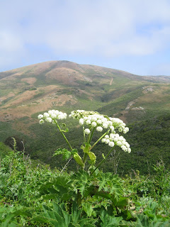
WHITE California manroot (round, spiny fruit), COAST MANROOT (more oval, less spiny), star lilies, spring snow (aka field chickweed and mouse ears), coastal morning glory, yarrow, THIMBLEBERRY (maple-like leaves, flowers larger than blackberry), strawberry, cow parsnip, milkmaids, subterranean clover (non-native, quail “birth control”), calla lilies (alien from S. Africa, Family Araceae, not a lily), STINGING PHACELIA, POISON HEMLOCK (red spots are Socrates’ blood), BLOW WIVES (white in seed as we saw it)
OTHER PLANTS
TWINBERRY, Pacific sedum (rounded leaves), Sea lettuce (aka hens and eggs, live forever), California sage, coyote bush, California barberry (shrub with holly like leaves), cape ivy (invasive from S. Africa), mugwort (great smell!), soaproot starting to send up flowers
BUTTERFLIES
PIPEVINE SWALLOWTAIL, California ringlet, BUCKEYE, spring azure. Re the green butterfly: what was the Bramble hairstreak has been split into two species. What we saw is now the COASTAL GREEN. Host plants buckwheats, Ceanothus, and deerweed, all of which we saw today.)
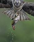
BIRDS
Male northern harrier being harried by a red-winged blackbird.
Starlings, red-winged blackbirds, scrub jays, great look at a spotted towhee, ravens, Anna’s hummingbirds, American goldfinches, song sparrow
Heard: wrentit, white crowned sparrow
MAMMALS brush rabbits
LICHEN Niebla (means fog in Spanish, grows only near the coast)
(Click here if you want to view and print a copy of this list. If you have Adobe Acrobat Reader on your computer you can print the document. Once you see the document on the "Scribd" Web site, click on the "Download" icon and then on the "PDF" icon to open the document on your computer).
Monday, May 5, 2008
Martin's Book "Hiking Marin"
The hike descriptions that Dick has included in the blog come from the 2nd edition (1999) of Hiking Marin written by Don and Kay Martin. The 2005 edition (with 8 more hikes listed) is available through Book Passage bookstore in Corte Madera for $21.95.
Weather Forecast for Wolf Ridge Hike
 Although Dick could not find a weather forecast specifically aimed at the Fort Cronkhite area, here is what the National Weather Service is predicting (as of about 1:30 pm on Monday) for the general area south of Mt. Tam and near the coast:
Patchy fog before 11am. Otherwise, mostly cloudy, then gradually becoming sunny, with a high near 69. West wind 9 to 12 mph increasing to between 17 and 20 mph. (If you click on this link to the NWS, you may be able to get a more updated forecast).
Accuweather is predicting only a high of 57 degrees with breezy conditions north at Stinson Beach. The Weather Channel is more optimistic, estimating the highs at Stinson to range from about the mid-50's to mid-60's during our hike in the GGNRA, closer to what the National Weather Service predicts for tomorrow.
Wolf Ridge Hike (May 6th) Preview
 Here's what Wendy promises us for our May 6th hike to Wolf Ridge from Rodeo Beach in the Fort Cronkhite area of the Golden Gate National Recreation Area:
"Wildflowers and views! This is a wonderful wildflower hike with the native cobweb thistle, bee plant, fringe cups, and many more!". (As usual, Dick Jordan will post Wendy's "What We Saw" list after tomorrow's hike).
If you've mislaid the directions to the trailhead, here's how to get there:
From Highway 101 southbound, take the last exit before the Golden Gate Bridge. Turn right, go under the freeway and get in the left turn lane to go through the one way tunnel with the 5 minute traffic light. Follow the road down (it will go right at the end of the lagoon and then left, so the lagoon is on your left) and park at the end of the road. (The beach will be on the other side of the road). It is a 40 minute drive from the College of Marin. Restrooms are located in the parking lot.
The Martin's Hiking Marin trail guide includes the following hike and trail map for this area. Presumably we'll be following their route:
(Click here to view and print out the hike details and map from the Martin book. If you have Adobe Acrobat Reader on your computer you can print the document. Once you see the document on the "Scribd" Web site, click on the "Download" icon and then on the "PDF" icon to open the document on your computer).
Subscribe to:
Posts (Atom)