Wednesday, March 25, 2009

Indian Valley Hike Photos Are On-Line

Pictures of the Indian Valley hike taken by Theresa Fisher and Dick Jordan are now on-line.

You can view them in the mini-slideshow window in the "Meandering In Marin On Tuesdays" blog, or by clicking here to go directly to the Picasa Web album of photos from the latest hike. (Albums of photos from our hikes can be accessed by clicking on the links on the right-hand side of the blog).

A Glorious Spring Hike Above The College (March 24)

While Spring began on Saturday with a wet and rainy day, followed by blustery winds on Sunday and Monday, Tuesday was just, Spring, Spring, Glorious Spring! And on our inaugural Spring College of Marin hike there not a cloud in the sky and only a few wisps of a breeze now and again.

After greeting the "Old Timers" and "Newcomers" at Lot#7 at the Indian Valley campus of the College of Marin and checking out bird and plant books for what we might see during the outing, we headed off around 10 a.m., walked past the baseball field, and hiked up the fire road to the old Pacheco Ranch pond. We paused along the shore of this liliputian lake for a history lesson from Wendy about the family that sold part of its lands for the college campus. Then we veered off to the right and began ascending thorough a mixed forest of Bay, Oak and Madrone on the Waterfall Trail which loops uphill for another half mile or less, then drops back down to the Indian Valley Fire Road. Wildflowers were abundant along the trail, butterflies flitted by us, and vireos chattered away, unseen, in the tree tops.

Instead of continuing back down the Waterfall Trail, we switched trails after passing over the crest of the ridge an hour into the hike and descended on the Jack Burgi Trail, then turned left and crossed the creek on to the Clark Melone Trail and followed that until we hit the fire road about noon. After a few minutes walk northward on the road we hit the other end of the Waterfall Trail and began clomping uphill once again.

During our outings in February and early March, the creeks were roaring down the hillsides. Today, the streams were almost silent. Mushrooms, popping up around every corner during Fall and Winter, were not to be seen. And unless we get April showers, the green, green hills of Marin will soon be fading into the yellow and brown tones of Summer.

As we traversed the Susan Alexander Trail, dinner bells were going off in our stomachs. About twenty minutes past the noon hour, we reached a broad, grassy meadow ringed with oak trees and plopped down for lunch. A Red Breasted Sapsucker flew across the meadow and landed in a nearby tree for his mid-day meal of tasty bugs.

Although a postprandial nap in the shade of a big tree would have been delightful, we were back on the trail after half an hour, heading upward for another ten minutes or so until we reached the junction with the Hill Ranch Trail. Along the way we had views eastward to San Francisco Bay and the hills beyond. Indian Warriors thronged under the madrone trees lining this section of the trail.

Moseying down the sometimes steep trail for another half hour or so brought us back to the Indian Valley Fire Road with less than a mile to go until we reached our cars. Along the way we stopped to search in vain for newt larvae, but found tree frog and bullfrog tadpoles doing "swimmingly" in one of the vernal ponds along the fire road. (Click here for Wendy's list of flora and fauna we spotted on this hike).

(Some of these trails we followed are not shown in the Martins' book, Hiking Marin; click here for a map of the Open Space Preserve that shows all of the trails we took on this hike). Theresa's GPS calculated the hike length at 4.6 miles. The Google Earth image below shows our route. (Click on the photo to open a larger image in your Web browser).


The vertical elevation graphic shows to two steep ascents and descents we made. (For some reason, the profile indicates that we started off below sea level!). (Click on the profile to open a larger image in your Web browser).

Mount Burdell Open Space Hike (March 31) Preview

Last year we hiked this area three weeks later on April 22nd. (Click here for a recap of that outing). Here's Wendy's description of the hike: " This loop takes us by Hidden Lake which is home to thousands of Pacific tree frogs! We may see cream cups, fiddleneck, popcorn flowers and blue-headed gilia, as well as seven or eight species of butterflies. This is the only spot where bitterroot, the Montana state flower, grows in Marin."

Directions to the trailhead: Take Highway 101 north and take the San Marin Drive exit. Go west on San Marin Drive. Turn right on San Andreas Drive. The entrance to the Open Space will be on your right. If you come to the dead end of San Andreas you've only gone about half a block too far. No lot but plenty of curbside parking. 30 minutes from College of Marin. No restrooms on this hike. (Carpoolers can meet at the Mission Street, San Rafael, Park & Ride lot around 9:05 am, or at the Smith Ranch Park & Ride lot around 9:15 am).

Weather forecast: As of Wednesday, March 25, the National Weather Service forecast for Novato on Tuesday, March 31st was sunny with a high near 65. (Click here for an updated forecast).

More on this hike: Hike "E13 Old Quarry Trail to Mt. Burdell" in the Martin's book, Hiking Marin, shows the general area that we'll be hiking in, although we'll probably turn left at intersection #2 and head directly to Hidden Lake rather than climb all of the way to the summit of the mountain as shown on the Martin's map. You can find a trail map and species list on the Marin County Open Space District's Web site for the Mount Burdell preserve. The Google Earth image below shows where we'll be hiking. (Click on the photo to open a larger image in your Web browser).
(Dick Jordan will be flying back from Phoenix on Tuesday and will miss this hike).

Cleansing Your Palate With Limoncello Sorbet

If you went on the Indian Valley Hike (March 24th), you may have heard Dick talk about heading home afterward to scarf up some home-made Limoncello (lemon-flavored sorbet). It's easy to make (click here for the recipe) if you have an ice cream maker (Dick uses a Ice Cream Bowl attachment that fits on his KitchenAid mixer).

The sorbet is a great palate cleanser between heavy or rich food courses, or just on its own. You can serve it with fresh berries, in season. At Christmas, Dick makes Limoncello Sorbet "Martinis" (click here for that recipe).

Meandering Blog's First "Birthday"

The "Meandering in Marin on Tuesdays" blog was "born" with our hike in the Open Space lands surround Indian Valley College on March 25, 2008.

The first hike photos posted to the blog and in the on-line photo album were ones shot by Theresa Fisher during the April 15, 2008 hike out at Chimney Rock in the Point Reyes National Seashore.

Thursday, March 19, 2009

MALT Art Show Painting Preview

The Marin Agricultural Land Trust's 12th Annual Ranches & Rolling Hills Landscape Art Show & Sale will take place at Druid's Hall in Nicasio on May 16th and 17th. (Click here for details on the show). You can preview some of the upcoming show's paintings at MALT's Facebook album.

Liking It By The Lake (March 17 "Final Exam")

Although Dick missed this hike, he offers this "interpretation" of the outing based information from Theresa Fisher and her hike pictures (which can be seen on the blog, or by clicking here to access the on-line photo album).

We had our most dramatic "wildlife encounter" of 2008 just before hitting the trail when we did this hike at the end of last year's Winter College of Marin term: As we stood in the Lake Lagunitas parking lot doing our usual pre-hike discussion of the past week's activities, an Osprey flew by carrying a fish in its talons. While that would not normally have been a very unique bird-watching event, what happened next was totally unexpected: A Bald Eagle suddently appeared and harassed the Osprey until it released its grip on the fish. The Eagle snatched the plummeting piscatorian snack out of mid-air and flew off with the Osprey in hot, vainless pursuit. (Although the I-J reported in December that a Bald Eagle was seen at Bon Tempe, it apparently did not make an encore appearance for this year's "Final Exam" hike).

While the country's national symbol didn't do a "fly by" this time, Theresa reports that three different species of woodpeckers (including a Northern Flicker and Acorn Woodpecker) were espied in a single tree near the end of the hike, and a very colorful male Bluebird was seen as well. Even though their "prime time" is drawing to a close, several of our "fungal friends" (including the "slime mold" being closely inspected by Lee in this photo) were found along the trail. Theresa says that Kathy won the "Mushroom Spotter of The Week" award by locating the vast majority of mushrooms that were seen. (Click here for Wendy's list of flora and fauna seen on this hike).

Unlike our hike last December from Alpine Lake to Bon Tempe which involved a lot of up and down over ridges which descend from Mt. Tam to the the lakes, this walk is almost level. (The Martins' book Hiking Marin, says there is a '50 elevation change. Interestingly enough, the following elevation profile Theresa created with her GPS shows the trail leveling out of an initial climb of about 350' over a distance of about 1.5 miles; click on the profile to open a larger image in your Web browser).

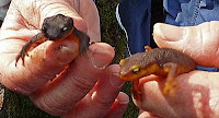
The recent damp weather meant that Wendy was still able to round up Rough-Skinned and California Newts for another "photo op" before the green hillside of Spring change to their Summer brown "clothes" and these litter critters no longer will come out to say "Howdy" when we hike in the Mt. Tam watershed.

A week before the hike, the National Weather Service was predicting a high temperature of 70 in Fairfax for our last of the Winter series of treks. Wednesday's fine weather and Theresa's photos of dew drops on the flowers, clouds in the sky, and jackets and rainhats on the "Meanders", show that the NWS was a "day late and a dollar short" with its forecast. While the day was cooler than originally predicted, it warmed up as morning moved into afternoon, and rain didn't wash out the post-hike "Final Exam" luncheon in the Lagunitas picnic area.

Although the hike begins just below the Lagunitas Lake Dam, the route we follow skirts the shoreline of Bon Tempe and never actually reaches Lagunitas Lake itself. This outing is really more of a stroll than a hike, due not only to the fairly minimal changes in elevation along the trail, but because its length (4.1 miles per the Martins' book, 3.8 miles per Theresa's GPS) is a little less than that of our typical treks. (Click on the Google Earth photo to open a larger version in your Web browser).

Despite the fact that Dick was unable to provide soup and wine for the "Final Exam" feast, the photos show that it was another ample and tasty repast. Silvia is now on "Doggy Duty" again and wasn't able to go along on the hike, but came for lunch with her new puppy "Hettie". Jean wasn't able to make the walk either, but joined the group for the meal. (Wendy kindly brought Dick some of the dessert treats which he pronounced quite yummy).

"Plant Meanders" in Marin

We usually see a variety of native and exotic plants during our "Meandering in Marin" hikes. For more "plant meandering" outings in the county, check out the field trips (March 22nd through April 21) offered by the Marin Chapter of the California Native Plant Society. If you want to go on an "armchair plant hunt" using your computer, click here to see reports of plants recently spotted blooming in Marin.

Wednesday, March 18, 2009

IVC Open Space Hike (March 24) Preview

We did this hike almost exactly one year ago on March 25th as the opening hike of the Spring College of Marin term. (Click here for a recap of that outing). Here's Wendy's outline for the hike: "Two loops combine to make an interesting hike. Last year we saw the first sky lupine, California pipevine and mist maiden as well as some late mushrooms. "

Directions to trailhead: Take Highway 101 to the Ignacio Boulevard exit. Go west and follow Ignacio Boulevard into the Indian Valley College campus. Our hike starts from parking lot #7 by the athletic field. (Click here for to view and print a map of the campus). Bring a dozen quarters to get a ticket from the parking machines ($3/day unless the rate has gone up since 2008). 25 minutes from College of Marin. Restrooms at trailhead. (Carpoolers can meet at Smith Ranch Park & Ride lot around 9:15-20 am).

Weather forecast: As of Wednesday, March 18, the National Weather Service forecast for Novato on Tuesday, March 24 was sunny with a high near 63. (Click here for an updated forecast).

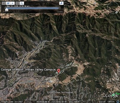
More on this hike: Two hikes in the Martin's book, Hiking Marin, cover the area that we'll traverse: "E6 Indian Valley FR - Waterfall Trail" and "E7 Schwindt - Wildcat Trails". You can also view and print the map and species list for the Marin County Open Space District's Indian Valley preserve. (For another hike description and more photos of the IVC Open Space, check out this page on the "Bay Area Hiker" Web site). The Google Earth photo below shows this area. (Click on the photo to open a larger image in your Web browser).

Tuesday, March 17, 2009

iPhones Are For The Birds

The other day, Dick posted an item on the blog about using GPS functions on cell phones while you're out hiking. On Sunday, the San Francisco Chronicle ran an article about a portable birding guide for iPhone users. Called "IBird", it has images of birds, range maps, and audio recordings of bird songs and calls, and comes in an "Explorer Backyard" version (145 birds; $4.99) or a beefed-up "Explorer Plus" version (891 birds; $19.99). There are separate geographical versions ("North", "South", "Western", "Midwestern", and "Canada") for $9.99/each. (Wendy mentioned that she had been out hiking with someone who was able to play bird calls on his iPhone --- this was probably the application he used).

To read the Chronicle article, click here. If you own on IPhone, go to the ITunes Stores to purchase the application.

Sunday, March 15, 2009

Cal Trans "Eagle Eye"

Nope, Cal-Trans doesn't have a camera aimed at Marin to see if you are violating the posted speed limit on your way to a "Meandering" hike. But it has aimed a camera at an eagle nest along Highway 44 near Redding. According to San Francisco Chronicle outdoor writer, Tom Stienstra, the Bald Eagle pair on the nest have produced three eggs and that the little eaglets are expected to begin to hatch by this weekend. (Click here to access the "Eagle Cam").

Finding The Trail with Your Cell Phone

During last week's hike in Blithedale Canyon, Theresa Fisher carried a little GPS gizmo and produced some neat mapping images of the hike. Those of us who carry cell phones on our "meanders" in Marin might be thinking "Hey, doesn't my phone have GPS built into it?".

Some phones, particularly "Smart Phones", do have GPS capabilities and, in theory, we could use one to find our way home if our FL (Fearless Leader) Wendy got lost. (Click here to read a New York Times article about using GPS-enabled cell phones in the "backwoods").

Oh, and if you bring your cell phone along on our hikes "Just in case President Obama should need to reach me", you may be part of a group that the New York Times describes as "those who like to chat loudly with colleagues while they ignore the natural beauty around them. For them, nature invented mountain lions."

Saturday, March 14, 2009

Dick's 15 Seconds of Fame

Last June, Dick traveled around Southeast Alaska for two weeks. One of his stops was at Petersburg where he and his wife explored nearby LeConte Bay and Glacier with local marine biologist Barry Bracken.

Local TV "adventurer" Doug McConnell of "Bay Area Backroads" has just posted Dick's account of that outing (entitled "Breaking the Ice in Little Norway") on his Web site, OpenRoad.TV. (Click here to read about Dick's "meander outside of Marin").

Thursday, March 12, 2009

It's For The Birds - Audubon Canyon Ranch

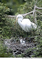
Aubudon Canyon Ranch where we hiked on February 24th (click here for a recap of that outing), opens to the public for the season this coming Saturday, March 14th. The San Francisco Chronicle's Tom Stienstra writes about the bird preserve in his weekly "Outdoors Getaway" article in the Thursday, March 12th edition of the paper.

The preserve will be open through the second weekend in July on weekends and holidays from 10am to 4pm (no appointment necessary), Tuesday - Friday (by appointment only) and closed on Mondays. The Griffin Trail (which we did not take during our hike) leads to an overlook of the trees where the egrets and herons nest.

For more information on visiting the ranch, call (415 ) 868-9244, or send an e-mail to acr@egret.org, or talk to Lillian Hanahan of our Tuesday "Meandering" group who is a docent at the ranch.

Wednesday, March 11, 2009

A Cool Sunny Day Above Blithedale Canyon

(Dick was down and out with a bout of bronchitis and missed the March 10th hike, but Theresa came through with the following write-up and several photos).

One of the Meanderers said it was below freezing this morning at her house and it was still very chilly when we met at the trailhead, necessitating the layering of all available articles of clothing and moving into a sunny spot to form our "circle of information."

We started the slight uphill climb shortly thereafter and broke into an open area after about 15 minutes allowing the sun's rays to hit us. Some of us began to unzip jackets and push up sleeves. but they were still needed.

For the next couple of hours we meandered in and out of the sun through forest and chaparral over gravel trails, wide dirt trails, and narrow rocky trails. We broke for lunch near the trail's edge at the top of the hill on the Blithedale Ridge Fire Road and enjoyed expansive views facing west and north. (Click here for Wendy's list of plants are critters we saw).

Except for a short uphill section, it was downhill after lunch as Wendy promised and we finished the needle's "eye" section of the trail in no time, returning to the original trail and retraced our steps back to the road. We passed more dogs on this trail, all seeming to be very happy, than any other we've hiked. (Our route is shown on the Google Earth photo below; click on it to open a larger image in your Web browser).

All together, we hiked about 4.7 miles (depending on where you parked), at an average speed of 1.3 mph and climbed about 800 ft, according to the GPS I'd brought along on the hike.

--Theresa Fisher

(A profile of the elevation changes during the hike appears below; click on it to open a larger image in your Web browser).


(Pictures of this hike taken by Theresa Fisher are now on-line. You can view them in the mini-slideshow window in the "Meandering In Marin On Tuesdays" blog, or by clicking here to go directly to the Picasa Web album of photos from the latest hike).

Tuesday, March 10, 2009

Bon Tempe/Lagunitas "Final Exam" Hike (March 17) Preview

Here's Wendy's description of our last Winter 2009 hike: "This is a lovely, level lakeside loop! Remember to bring your contribution to our gourmet feast, a plate, cup, and utensils." (We did our "Final Exam" for Winter 2008 here, too, in the pre-blog days, so no account of our last hike is available).

Directions to trailhead: As you enter Fairfax on Sir Francis Drake Boulevard. jog left when you see the movie theater and make an immediate right. This puts you on the street that parallels Sir Francis Drake, but is on the other side of the Parkade. Make the first left which is Bolinas Avenue. Follow the Bolinas-Fairfax Road. for about 1 mile. Turn left onto Sky Oaks Road. (Click here for directions from the MMWD Web site).

You’ll need to pay at the kiosk ($7/day; or purchase a pass for $50 for Marin residents, $25 for seniors 62 and older, good through next January; pay with $1, $5 and $10 bills or Visa or Mastercard).

Follow the paved road on to Lake Lagunitas. We’ll have lunch at the picnic area at Lake Lagunitas so you don’t need to carry the food for the potluck.

Time: 30 minutes from College of Marin. Restrooms at trailhead, portables en route. (Carpoolers can meet at St. Rita's around 9:15-9:20 am).

Weather forecast: As of Wednesday, March 11th, the National Weather Service forecast for Fairfax on Tuesday, March 17th, was sunny with a high near 70, perfect weather for our after-hike luncheon. (Click here for an updated forecast).

More on this hike: Hike "C13 Bon Tempe Lake Trail" in the Martins' book, Hiking Marin, shows the general area where we will be hiking. However, we'll start and end at intersection #2 on their map, rather than at Bon Tempe dam. (Click here for an MMWD map that shows this area). The Google Earth image below shows both lakes in a view looking back towards Fairfax. (Click on the photo to open a larger image in your Web browser).

Thursday, March 5, 2009

Going With The Flow (Into MMWD Lakes)

If you didn't turn to the back of the San Francisco Chronicle "Sporting Green" section on Thursday, March 5th, you missed Tom Stienstra's article "Go With The Flow" about hiking to the lakes in the Mount Tam watershed. When we hiked from Alpine Lake to Bon Tempe on December 16th, water levels in Alpine were still quite low, but a photo accompanying Stienstra's article shows water now rushing over the spillway. (Click here for information on MMWD reservoir levels as of March 1st).

Stienstra omits Phoenix Lake (where we hiked to this past Tuesday), but covers two hikes we've not done in the last year of "Meandering in Marin": The Kent Lake Pump Trail (starts just before Alpine Dam and heads downstream; see hike "C10 Old Sled - Old Vee - Carson Falls" in the Martins' book, Hiking Marin for a map that shows the trail location) and the Kent Lake Peters Dam Trail (trailhead by Shafter Bridge; see hike "H7 Kent Lake - San Geronimo Ridge" in the Martins' book, Hiking Marin).

Wednesday, March 4, 2009

Yet More Ways to Meander in Marin

We've previously suggested that if you aren't getting in enough hiking and nature "education" on our Tuesday "Meanders", you could go on an outing with the Marin Agricultural Land Trust, do a hike on Angel Island, or join the Marin County Open Space and Parks Department for a trek in Marin. (Of course, don't forget to sign up for the Spring "Meandering in Marin" hikes offered through the College of Marin if you haven't done so yet).

Here are two more ways to enjoy "The Great Outdoors" in Marin:

Sign Up for An Outing with Point Reyes Field Seminars:

The Spring 2009 (March through September) Point Reyes Field Seminars catalog has just come out. (Click here to view it on-line). Our Wendy is doing these classes (all of which cost $50, $45 for PRNSA members):
  • Wildflowers of Chimney Rock (Sat., Apr. 11, 10 am - 3 pm; our Tuesday "Meander" there will take place earlier that week)
  • Exploring Ring Mountain (Sun., Apr. 19, 10 am - 3 pm)
  • Butterflies for Beginners (Sat., Apr. 25, 10 am - 3 pm)
Other PRFS classes worth considering include:
  • Spring Bird Songs (Lisa Hug; Sun., Mar. 22, 9 am - 3 pm)
  • Poles for Hiking and Walking (Jayah Paley; Sat., Jun. 20, or Sun., Sept. 20, 10 am - 4pm)
  • Adventures in Twilight (Sharon "Heron" Barnett; Sat., Jun. 27, 6 - 9 pm)
Go to the on-line catalog or phone (415 663-1200, Ext. 373) for more information or to register for these and other classes.

Take A Hike With Mount Tam HS District's "Adult Ed" Program

If you want to hike twice weekly, sign up for Wendy's Spring "Meanders" through the College of Marin and also one of tw0, seven-week "classes" ($125 for each series) led by Judy Hall through the Mt. Tam program:
  • Adventure Hiking in Marin (7 Sundays, Apr. 5 - May 24, 9:30 am - 1:30 pm)
  • Adventure Hiking Meets the [West Marin] Stage (7 Fridays, Apr. 3 - May 15; 8:15 am - 2:215 PM; park at Fairfax Parkade and ride the bus to and from West Marin)
For more information, call the Tamalpais Union High School District Adult and Community Education program (415 945-3730) or go to its Web site (http://www.MarinLearn.com).

Wendy's Birthday Song (By Silvia)

If you weren't on our February 24th Audubon Canyon hike, you missed Silvia's cleverly crafted song to fete Wendy on her recent birthday. If you were along, you might want to adapt this twist on "Hi Lili, Hi Lo" into a natal day tune for a friend or family member. Click here to view and print the lyrics from Silvia's version of this movie classic. (A little "tilted" to one side after riding around in Dick's day pack during our Phoenix Lake hike before he scanned it into his computer for uploading).

Tuesday, March 3, 2009

Bird's Eye With of Blithedale Loop Hike (March 10)

This Google Earth image shows Marsh Drive and West Blithedale Avenue in Mill Valley where we'll meet to start our hike next Tuesday, March 3rd. We'll head up to the ridge at the top of the picture (which looks east over Corte Madera and Larkspur to the Richmond-San Rafael Bridge), hike along it, then double back to our starting point. (Click on the photo to open a larger image in your Web browser).

Blithedale Canyon Hike (March 10) Preview

Last year we did this hike on March 4th P.M.B. (Pre-"Meandering Blog"), but Dick recalls that we had a beautiful sunny day with great sweeping views over to the East Bay. Here's Wendy's description for this year's outing: "A loop with great views of Mt. Tamalpais! We should see the beautiful mist maidens, mission bells, and huckleberry and tree poppies in bloom. Probably a 9 fern day!"

Directions to trailhead: Take East Blithedale exit from Highway 101. Where you cross Throckmorton it becomes West Blithedale. Go .9 miles and look for parking at Marsh Drive and West Blithedale on both the left and the right sides of the street. (Click here for a map and driving directions). Time: 30 minutes from COM. (Carpoolers can meet at the Greenbrae Parking & Ride lot around 9:15-9:20 am). No restrooms at trailhead.

Weather forecast: As of Tuesday evening, March 3rd, the National Weather Service forecast for Mill Valley on Tuesday, March 10th was partly sunny with a high near 54. (Click here for an updated forecast).

More on this hike: Hike "B1 Blithedale Ridge - Corte Madera Trails" in the Martins' book, Hiking Marin, shows the area we will be hiking in although our route may differ slightly from the one they set out for their hike. (This area is also shown on the map of the Marin County Open Space District's Baltimore Canyon Preserve and Blithedale Summit Preserve).

Dodging Rain Bullets (Phoenix Lake, March 3)

A quick look out the window at the rain pouring down from the sky Tuesday morning suggested that crawling back into bed rather than into our hiking duds would be the sensible thing to do. But by 9 am the sun was shining in most of Marin, luring ten of us out the door to meet up with Wendy at Deer Park.

When we arrived at the trailhead, the sun had been obscured by clouds and would only make a brief cameo appearance the rest of the day. But except for a few errant drops of rain at the end of our lunch break and a few minutes of earnest showers during the ensuing thirty minutes, we once again had winter hiking weather karma and finished our outing an hour or so before thunderstorms replete with cannonades of thunder and hail hit Marin in mid-afternoon. (Click here if you're wondering about the effect of the last three weeks of rain on MMWD reservoir levels).

Around 10 am we set off up the Deer Park Fire Road, stopping along the way to ogle a dazzling hillside display of a multitude of different fern species. Within 15-20 minutes we'd reached the junction with the Six Points Trail, turned south, and began a slow, half-hour climb through the forest to the top of the ridge. Mushrooms could still be found, but wildflowers such as Hounds Tongue, Milk Maids, and Blue Dicks, were scattered in profusion under the trees and in the more open meadows. Buckeyes were leafing out. Water rushed down the many streams we crossed. (Click here for Wendy's list of flora and fauna spotted on this hike).

When we reached Six Points, we stopped briefly to discuss the ranching history of the "Worn" family, and to look in vain for six trails (we only found five) trailing off like wagon wheel spokes at this hub. Just before 11 o'clock, we began the traverse across the flank of Bald Mountain that would ultimately lead us down to Phoenix Lake. We were mostly "out of the woods" here and wind gusting up the south-facing slopes blew chill at times. We could see south towards Mount Tam and back west toward White's Hill, but low clouds blocked our view of those peaks.

Almost exactly at the stroke of noon we arrived at Phoenix Lake, and as if on cue, a Great Blue Heron glided from the near to the far side of the lake in greeting. The pale green hills reflected in the khaki-colored water as we sat down along the shore for our mid-day repast. Behind us the dark rustic home of the groundskeeper or foreman of the old Porteous Ranch looked over our shoulders toward the lake. A Black Phoebe flitted about trying to pick a lunch tasty insects out of thin air.

About a half-hour later we finished our meal, packed up our gear, and resumed our loop back to Deer Park passing the grape-stake fence of the ranch on one side of the road and a dried out bed of cattails on the other. Within ten minutes we entered and exited a small grove of redwoods, then began a slow, steady ascent up the wide Shaver Grade to Five Points. As we toiled uphill in brief rain shower, water made its way downhill in the creek next to the road. Here and there was evidence of work being down to reduce the erosion of the hillsides.

Around 1 pm we looked east to patches of blue sky and white, billowy clouds hanging over Bald Hill, and the rain had ceased. We stopped to chat and use "the facilities" at the Five Points junction, then dropped down the other side of the ridge on the Deer Park Fire Road. When we got to the intersection with the Junction Trail, we debated whether to take the somewhat easier, wider path down the fire road, but the promise of spotting Baby Blue Eyes prompted us to descend on the narrow, and occasionally rocky, Junction Trail. Within a couple of minutes we saw the lovely little blue and white flower right next to the trail.

When we reached the bottom of the hill we could have used a boat to get through the muck and water than had piled up where the Junction Trail meets the Deer Park Fire Road, just opposite the spot where we had left the fire road to make our way up to Six Points a little over three hours earlier. In less than a quarter hour we'd returned to our cars and moved that much closer to true Spring weather.

(This Google Earth satellite photo shows the area we hiked in on Tuesday. Click on the photo to open a larger image in your Web browser).


(Pictures of this hike are now on-line. You can view them in the mini-slideshow window in the "Meandering In Marin On Tuesdays" blog, or by clicking here to go directly to the Picasa Web album of photos from the latest hike).