Thursday, June 27, 2013

Bull Point Hike (7/2) Preview

"Back Off, Or Get Stomped!" This week we head through Inverness to hike on the ocean side of the Point Reyes National Seashore. Here's Wendy's description for this hike: "A beautiful but soggy (in places) walk timed to see the Coast Lilly blooming in its only site in Marin!

Other endangered flowers we've seen other years incldued the Swamp Harebell, Large Flowered Lianthus, and Point Reyes Checkerbloom. We may also see Yellow-Eyed Grass, Tinker's Penny, White-Flowered Bog Orchid, and Hooker’s Evening Primrose. Some off-trail walking but little elevation gain." (Click here for the recap of our Bull Point hike on July 7, 2009.).

Directions to the trailhead: Take Sir Francis Drake Boulevard west to Olema. Turn right on Highway 1, then make an immediate left onto Bear Valley Road. Continue past the road to Park Headquarters (stop here for a restroom break; there are no porta-potties at the trailhead) and go left when you hit Sir Francis Drake again.

Go through Inverness. Go left at the "Y" (right takes you out to Pierce Point) and pass MCI and RCA stations on your right. The Bull Point parking lot will be on your left.  Carpool leaves St. Rita at 8:50 a.m.

Weather forecast: As of Saturday, June 30, the National Weather Service forecast for the hike was  patchy fog before 11am. Otherwise, mostly sunny, with a high near 64. (Click here for an updated forecast).

More on this hike: Hike "H11 Bull Point and South Beach Trails" in the Martins' book, Hiking Marin, shows this as 4.0 mile out and back hike. Tracy Salcedo-Chourre's book, Exploring Point Reyes National Seashore and Golden Gate National Recreation Area, pegs it at 3.6 miles as does the park's North District Hiking Map. The Google Earth image below shows the area where we'll be hiking. (Click on the image to open a larger version in your Web browser).

Monday, June 24, 2013

John Muir Trail Backpacking Partner Needed

Susan Alcorn, Bay Area hiker, travel writer, and author of Camino Chronicle and other hiking books, has contacted Dick Jordan on behalf of a Marin man looking for a companion to hike a section of the John Muir Trail this summer.

Here's more information about him and the trip:

"I'm a 59 year old man looking for a partner to backpack Kearsarge Pass to Whitney Portal this summer. I'm an experienced backpacker in good shape. My cousin was supposed to go with me but he had to drop out. I've asked around, put up a sign at my gym. I've been unable to find a web site for older backpackers looking for hiking partners. I'm considering going alone, but it is not something I generally recommend to others. 

"It's frustrating being the only one in your circle still fit enough. I live in Marin County, but I don't care where the other person is from. I don't even care about gender (I'm in a committed relationship) but I understand no woman would be advised to go into the mountains with a man she didn't know, so as a matter of practicality I'm looking for another man."  
According to Susan, he does not have a permit yet, but a large percentage are given out "first come, first served" at the ranger station. He hopes to do his hike the second week in early July, but is open to modifying that plan.

If you're interested in joining him, or know someone else who might be, e-mail Dick.

Saturday, June 22, 2013

Latest Tuesday Hike Weather Update (Monday Noon)

As of noon on Monday, June 24th, the National Weather Service forecast for the Olema Valley area where we're scheduled to hike from Bear Valley to Five Brooks was revised and is not looking promising:

Rain. High near 63. South wind 8 to 15 mph, with gusts as high as 18 mph. Chance of precipitation is 90%.

Click here for an updated forecast.

Linda Reports in From Europe

In case you didn't notice, Linda Oqvist hasn't been hiking with us since early May.

That's because she and her husband, Peter, are spending five months in Europe.

Here's her first report on the trip, along with photos:

"We had a cold start to our trip -- coldest Spring in England in 50 years, and that was after a long cold winter. Note the winter clothes below!


And I wish I had a Wendy here…..gradually becoming familiar with the trees, etc. The bluebells and wildflowers have been so abundant; bird song, amazing - though I have no idea what they are.


Hope everyone is well.

We are now in Sweden for about 4 weeks (and Denmark, maybe Germany too) - then back to southern England where I am hoping it’s going to be a lovely summer…..more so for the Brits than us - they need it!

Best wishes to all, Linda

Thursday, June 20, 2013

Bear Valley to Five Brooks Hike (6/25) Preview

We continue our "Summer at the Seashore" series of hikes this week by starting at the Bear Valley Visitor Center in Point Reyes National Seashore and hiking south to Five Brooks. (Here's the recap from the June, 2009 trek.)

Here's Wendy's description of the outing: "We’ll start by checking out dragonflies and birds on the pond at Five Brooks, then carpool to Bear Valley. In past years we've seen Satyr Commas, Acmon Blues, Field Crescents, California Tortoise Shells, Pale Swallowtails, Western Tiger Swallowtails, and dragonflies including Cardinal Meadowhawks, Western Pondhawks, and Eight Spotted Skimmers. This level hike takes us through Vedanta Retreat and Stewart Ranch back to Five Brooks."  
THIS IS A SHUTTLE HIKE (CALL OR E-MAIL WENDY IF YOU'RE COMING: Home: 415 457-3949 E-mail: bdreskin@comcast.net).

Directions to trailhead:  We'll meet at Five Brooks at 9:30 am. Take Sir Francis Drake to Olema, turn left onto Highway 1, and continue south until you see the right hand turn off the highway to Five Brooks. We'll leave some cars at Five Brooks, so we'll need some drivers not in a hurry to head home after the hike to drive those who left their cars at the trailhead back to Five Brooks.

Restrooms (porta-potties) at Five Brooks and (real-deal flush toilets) at Bear Valley. Carpool from St. Rita's at 8:55 am.

Weather forecast: As of Thursday, June 20th, the National Weather Service forecast for the hike was a chance of rain. Mostly cloudy, with a high near 66. (Click here for an updated forecast).

More on this hike: Hike "F8 Five Brooks Trailhead to Bear Valley" in the Martins' book, Hiking Marin, does this 4.4 mile hike in the reverse direction from our trek. Our route will roughly parallel the San Andreas Fault which splits the Olema Valley down its middle.

After about a mile and a half we'll begin to cross the 2,000 acre parcel owned by the Vedanta Society of Northern California. Later we'll skirt the the historic Stewart Ranch. This trail is popular with equestrians, and we're likely to encounter horses and cattle along the way.

The elevation change is only 350' over the length of the trail, and many sections are quite flat or downhill. (Click here to view the Rift Zone Trail on the park's South District Hiking Map).

The Google Earth image below gives you a bird's eye view of the route will follow; the Bear Valley parking lot is at the far right, and "Mill Pond" at the far left is at Five Brooks. The yellow line marked "Shoreline Highway" is Highway 1. (Click on the image to enlarge it in your Web browser).

Saturday, June 15, 2013

Tomales Bay SP Shell Beach Hike (6/18) Preview

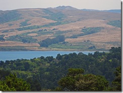
Looking Across Tomales Bay to Three PeaksSomething old and something new!

We’ll hike from (but not meet at) the same parking lot on Pierce Point Road that’s just before the turn to Heart’s Desire.  Last year there were ripe huckleberries! Wetland plants like Marsh Rosemary, Ledum and Jaumea should be in bloom.

THIS IS A SHUTTLE HIKE! CALL OR E-MAIL WENDY IF YOU'RE COMING!
Home: (415) 457-3949, E-mail:
bdreskin@comcast.net.
 
Directions to the trailhead: Meet at the Shell Beach parking lot, not at the trailhead (we’ll carpool to it from the Shell Beach lot).

After you pass Inverness, take a right on Camino del Mar (there’s an inn on your left; it’s just where the road starts going uphill.) Follow it to the parking lot. (Click here for a Google Map that shows this area; you may have to zoom in and re-center the map to see Camino del Mar).

No restrooms at trailhead; stop at the Bear Valley Visitors Center on the way if you need to powder your nose.

Meet at 9:00 am to carpool from St. Rita.

Weather forecast: As of Saturday, June 15th, the National Weather Service forecast was patchy fog before noon. Otherwise, mostly cloudy, with a high near 62. Click here for an updated forecast..

More on this hike: "G15 Pierce Point Road to Shell Beach" in the Martins' book, Hiking Marin, shows the area in which we'll be hiking. The trails are also shown on page 4 of the Tomales Bay State Park brochure. The Google Earth image below shows Heart's Desire and Shell Beaches as seen from the east side of Tomales Bay. (Click on the image to open a larger version in your Web browser).

Friday, June 14, 2013

Update on Marin Headlands Road Work

Here's an update from The Marine Mammal Center on road work in the Marin Headlands, as of 6/13/2013:

The new parking lot by The Marine Mammal Center and Mitchell Road is on track to be completed by the end of the month.

Work will begin on the Fort Cronkhite parking lot after the fourth of July.

Work on deteriorated areas of Field Road will begin after the fourth of July as well. Specific dates and work hours will be finalized once improvements on Alexander Avenue are complete Expected impact remains the same (one lane open at all times, max. 15 minute delays).

Reopening the tunnel access to the Headlands area remains a priority. Hopefully, it will be open by the Fourth of July.

In the interim, continue to observe the closure. No vehicles should be using the tunnel at any time.

Bicyclists are allowed to use the tunnel before 8am and after 5pm ONLY on weekdays and all day during weekends.

During construction hours of 8am to 5pm on weekdays, all bicycles must use Conzelman Road to enter and exit the Headlands.

Friday, June 7, 2013

Shartphone Bird and Critter Logging Apps

If you want to track your bird sightings on your smartphone (iPhone or Android; also works on iPad and iPod Touch) instead of making paper and pencil notes, consider buying the BirdLog app from BirdsEye. You can contribute those sightings to a database maintained by Cornell University.

Here's the app's description on iTunes:

"BirdLog is the first and only mobile data app for quickly and easily recording and submitting your sightings directly into eBird from the field! Forget about notebooks, pencils and sitting at your computer. Transform your bird sightings into eBird submissions to build your own lists while sharing your sightings and supporting conservation.

You’ll enter more lists with BirdLog and enter them more accurately. It is easy to tally birds as you go—and thus counting them more accurately, automatically capturing the time and duration, and using the device’s GPS and map interface for greater precision of locations.

BirdLog was developed by active eBird users as a power app for submitting data into eBird. If you are not already familiar with eBird, we recommend that you visit ebird.org and register before using BirdLog the first time."
This YouTube video explains how the app works.


(If you buy the $9.99 App for Apple devices through this link, Dick Jordan will get a few dimes and nickels as a commission).

Project Noah also involves "critter cataloging."  Here's what its Website says:
"Launched out of NYU’s Interactive Telecommunications Program in early 2010, the project began as an experiment to mobilize citizen scientists and build a digital butterfly net for the 21st century. Backed by National Geographic, Project Noah is mobilizing a new generation of nature explorers and helping people from around the world appreciate their local wildlife. Our community is harnessing the power and popularity of new mobile technologies to collect important ecological data and help preserve global biodiversity."
 Its apps for iPhone and Android phones are free. This video demonstrates the iPhone version.


(Both BirdLog and Project Noah were reviewed at page 60 of the May/June 2013 issue of Sierra magazine.)

Wednesday, June 5, 2013

Summer 2013 Construction Projects in Marin

Three construction projects taking place in Marin this summer may affect our driving times to and from trailheads in West Marin.

MMWD Project Near the San Anselmo Hub

From June 3 through approximately August 15th, MMWD will be replacing pipeline from west of United Market on Redhill Avenue, through "The Hub," and west on Sir Francis Drake Boulevard to a point near the Redhill Shopping Center.

One lane will probably be closed in each direction (westbound, 8 am - 3:30 pm, eastbound 9 am - 4 pm). Allow at least an extra 15-20 minutes driving time if you will be passing through the construction area.

You may or may not be able to avoid most of the traffic delay be exiting Highway 101 at the Greenbrae interchange and taking Sir Francis Drake to and from San Anselmo, rather than driving through San Rafael.

When the construction work is going on between The Hub and the Redhill Shopping Center, it may or may not be faster to take Center Boulevard rather than Sir Francis Drake between San Anselmo and Fairfax.

(Read more about the project in this Marin I-J story.)

College of Marin Construction Project Begins This Month

Demolition of existing buildings and construction of new ones at the College of Marin's Kentfield campus will begin June 17th and continue until approximately August 9th.

It's unclear whether there will be any significant traffic delays on Sir Francis Drake Boulevard near the campus during that time period, but if you plan on driving up from Highway 101 on Drake to avoid traffic delays due to the MMWD project near the San Anselmo Hub, you should probably allow extra time to get to St. Rita's or the trailhead.

(Read more about the COM project in this Marin I-J story.)

Olema Hill Slide Repair

More than two years have passed since the collapse of a section of Sir Francis Drake Bouleavrd between Tocaloma and the crest of the hill above Olema.


Repair work should begin by the end of June and be completed sometime around Labor Day.

It's unclear whether the work will result in traffic delays on that section of Drake, or require drivers to detour through Point Reyes Station in order to reach the Seashore and Olema.

(Read more about the project in this Marin I-J story.)

Tuesday, June 4, 2013

Laguna Trailhead Hike (6/11) Preview

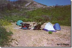
Coast Camp This week we return to Point Reyes National Seashore.  We explore four habitats: coastal scrub, beach, marsh, and a riparian (streamside) habitat with alders and willows. Lunch at the beach. We may see some of the Tule Elk that have been transferred from Tomales Point. (Click here to view photos from a past hike.)

Directions to trailhead: Take Sir Francis Drake Boulevard. west to Olema. Turn right on Route 1, then make an immediate left onto Bear Valley Road. Continue past Park Headquarters (stop here if you need a restroom --- there is none at the trailhead) and go left on Limantour Road.

Turn left at the sign for the youth hostel. Follow that road until you see a right turn across a bridge to the Laguna Trailhead by the Clem Miller Education Center. Park in the parking lot.

55 minutes from College of Marin. Carpoolers can meet at St. Rita’s Church in Fairfax at 9:00 a.m.

No restrooms at trailhead. Outhouse en route before lunch.

TRAFFIC DELAYS DUE TO CONSTRUCTION WORK NEAR SAN ANSELMO "HUB"

From June 3 through approximately August 15th, MMWD will be replacing pipeline from west of United Market on Redhill Avenue, through "The Hub," and west on Sir Francis Drake Boulevard to a point near the Redhill Shopping Center.

One lane will probably be closed in each direction (westbound, 8 am - 3:30 pm, eastbound 9 am - 4 pm). Allow at least an extra 15-20 minutes driving time if you will be passing through the construction area.

You may or may not be able to avoid most of the traffic delay be exiting Highway 101 at the Greenbrae interchange and taking Sir Francis Drake to and from San Anselmo, rather than driving through San Rafael.

When the construction work is going on between The Hub and the Redhill Shopping Center, it may or may not be faster to take Center Boulevard rather than Sir Francis Drake between San Anselmo and Fairfax.

Weather forecast:  As of Tuesday afternoon, June 4, the National Weather Service forecast for the hike was mostly cloudy, with a high near 59. (Click here for an updated forecast).

More on this hike:

From the Laguna Trailhead we'll go southwest on the Laguna Trail to its junction with the Fire Lane Trail, follow that down to the ocean, take a short “side trip” to Coast Camp to use the “facilities”, then hike northward paralleling the sea on the Coast Trail before turning back inland to the Laguna Trailhead.  Total distance covered should be approximately 5.2 miles.

The “Laguna-Coast Trail Loop” hike in Exploring Point Reyes National Seashore and Golden Gate National Recreation Area by Tracy Salcedo-Chourre describes the route we’ll take.  The trails we’ll follow are shown on the the North District Hiking Map on the Point Reyes National Seashore Website.

You will also find them on the map for hike “G4 Sky – Woodward Valley – Coast Trails” in the Martins’ book, Hiking Marin, although we are not doing that specific hike.