Tuesday, February 25, 2014

"Rebels With A Cause" Screening (Fri., 2/28)

If you missed seeing Rebels With A Cause, a documentary by filmmakers Nancy Kelly and Kenji Yamamoto about how a cast of "local heroes" preserved tens of thousands of acres of land along the coast north and south of San Francisco, when it was screened at the 2012 Mill Valley Film Festival, you can catch it this Friday, February 28th, at 7:00 pm at the Tamalpais Valley Community Center, 203 Marin Ave., Mill Valley; 388-6393; www.tcsd.us. Admission is free.

One of the "stars" of the film is Dick Jordan's long-time friend, Amy Meyer, who along with the late Edgar Wayburn and "a cast of thousands," was responsible for creation of the Golden Gate National Recreation Area. You can read a review of the movie on Dick's Website, Tales Told From The Road.


Here's the film's trailer.


(Click here if the movie player window doesn't appear in your e-mail message.)

Deer Park to Phoenix Lake Hike (3/4) Preview

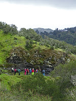
This is a scenic hike with lunch at Phoenix Lake.  We should see Red Larkspur, Gypsum Spring Beauty, Baby Blue Eyes, and Ground Iris  Maybe we'll hear the first orange-crowned warblers of the season!  (Click here for a recap of our hike in March 2010 or here for photos from past hikes.)

Directions to trailhead:  Go west on Sir Francis Drake Boulevard to Fairfax. As you enter Fairfax, turn left at the gas station, and make an immediate right in front of the movie theater. This puts you on Broadway. Make the first left onto Bolinas Avenue. Just after it veers left, turn left on Porteous Avenue. Follow it to the parking lot at Deer Park.

(Click here for a MapQuest map showing the location of Deer Park; click on #1 to get driving directions and estimated driving time from your location.)

15 minutes from College of Marin. Carpoolers can meet at St. Rita's Church at 9:30 a.m.

Restrooms at trailhead.

Weather forecast:  As of Tuesday afternoon, February 25th, the National Weather Service forecast for the hike was partly sunny, with a high near 65. (Click here for an updated forecast).

More on this hike: Presumably we'll follow the same route as in the past. The Martin's Hiking in Marin trail guide does not have a single map and directions for our hike from Deer Park School to Phoenix Lake and back, but you can use the following two maps and hikes from their book to piece together our path:

Start off using the Martin's Hike "C6 - Deer Park Road - Yolanda Trail." Head up the Deer Park Fire Road to Oak Tree Junction, then turn left (to the south) and hike uphill on the Six Points Trail. When you reach the Six Points junction, switch to Hike "C4 - Hidden Meadow - Yolanda Trail" and hike down the Yolanda South Trail to Phoenix Lake.

Using that same hike and map, follow Shaver Grade uphill, and while doing so, refer back to the C6 hike and map to follow the Grade to Five Corners. Continue straight down Deer Park Fire Road to Boy Scout Junction. Cross the fire road and take the Junction Trail back to its intersection with Deer Park Fire Road (just where you turned off onto Six Points Trail when you were headed toward the lake).

Click here for a printable map of the MMWD watershed which shows these trails.

Here's a Google Earth view looking from Deer Park over Bald Hill towards Phoenix Lake. We'll head from bottom to top and a little left of center in this picture to reach the lake, then turn right at the lake and go from top to bottom by starting up Fish Gulch (shown in purple lettering on the photo) and onto the Shaver Grade (shown in white lettering). Click on the photo to open a larger image in your Web browser.


Monday, February 24, 2014

Spring Hike Registration Opens Today!


Just a quick reminder that registration for the Spring Meandering hikes (and other COM Community Ed classes) begins today, Monday, February 24th.


Here are the course numbers/dates for Wendy's Meandering classes:


Tuesday Class

CRN# 35017 EC

7 Tuesdays March 25 - May 13 (no class on Tuesday, April 15)

Fee: $120

Monday Class

CRN# 35016 EC

7 Mondays March 24 - May 12 (no class on Monday, April 14)

Fee: $120


Sunday, February 23, 2014

"The Invisible Peak" - A Documentary Film About Mt. Tam

Thanks to Linda Oqvist for letting we Meanderers know about the documentary film, The Invisible Peak, which traces the history of the West Peak of Mount Tamalpais before, during, and after the construction of an Air Force facility atop the mountain in 1950.

The 21-minute film is narrated by actor Peter Coyote.


(Click here if the movie player doesn't appear in the e-mail.)

Steep Ravine Hike (2/18) Photos Now Online!

Photos taken by Theresa Fisher during last week's Steep Ravine hike are now online!

View them on the Meandering blog or click here for the on-line album.


(If the video player doesn't appear in your e-mail, click here to go the blog view a video of us climbing the ladder in Steep Ravine.)

Thursday, February 20, 2014

Laguna Trailhead Hike (February 25) Preview


Marge will be filling in for Wendy again this week as we repeat a hike we haven't done in quite a long time: "Today we take a different route from a familiar trailhead to make a 4.6 mile loop. We get our exercise on the uphill before lunch and then stroll downhill to complete the loop."

Directions: Take Sir Francis Drake Boulevard west to Olema. Turn right on Route 1, then make an immediate left onto Bear Valley Road.

Continue past Park Headquarters (turn in if you need a restroom; there are none at the trailhead) and go left on Limantour Road. Turn left at the sign for the youth hostel. Follow that road until you see a right turn across a bridge to the Laguna Trailhead by the Clem Miller Education Center. Park in the parking lot.

To cut half a mile off the hike, turn right instead of left at the sign for the youth hostel, leave your car at the Muddy Hollow parking lot and ride with a friend across the Limantour Road to the trailhead.

Click here for a MapQuest Map that shows the Muddy Hollow area, and click on #1 to get driving time and directions from your location.

55 minutes from College of Marin. Carpoolers can meet at St. Rita Church in Fairfax at 8:55 a.m.

No restrooms at trailhead.

Weather Forecast: As of 5:00 p.m. on Thursday, February 20th, the National Weather Service forecast for the hike was mostly cloudy, with a high near 61. (Click here for an updated forecast).

More on this hike: Hike "G5 Bayview - Muddy Hollow - Laguna" in the Martin's book, Hiking Marin, shows the route we'll take. (Point 1 on their map shows where you'll leave your car to cut 0.5 miles off the hike. Point 2 is where we'll leave the other cars and actually begin hiking.)

Tuesday, February 18, 2014

Blithedale Canyon Hike (2/11) Photos Now Online!

Photos taken by Theresa Fisher during last week's Blithedale Canyon hike are now online!

View them on the Meandering blog or click here for the on-line album.

Saturday, February 15, 2014

Spring Meandering Hike Series Registration Opens February 24th!

Wendy is in deepest, darkest Africa for a couple of weeks, but the Spring 2014 College of Marin Community Education catalog should be arriving in your mailbox today or soon thereafter.

Registration for the Spring Meandering hikes (and other COM Community Ed classes) begins on Monday, February 24th.

Here are the course numbers/dates for Wendy's Meandering classes:


Tuesday Class

CRN# 35017 EC

7 Tuesdays March 25 - May 13 (no class on Tuesday, April 15)

Fee: $120

Monday Class

CRN# 35016 EC

7 Mondays March 24 - May 12 (no class on Monday, April 14)

Fee: $120


Wednesday, February 12, 2014

Save The Frogs!

The foothill yellow-leg frog is in trouble.

 But you can help by becoming a MMWD "Frog Docent."

Here's what the program is all about, per the MMWD Website:

"The foothill yellow-legged frog (Rana boylii) is native to parts of the Mt. Tamalpais Watershed and is listed as both a federal and state species of "special concern,” which means its population is declining. The foothill yellow-legged frog has disappeared from more than 45 percent of its historic range in Oregon and California due to:
  • habitat loss and degradation,
  • disease and
  • introduction of exotic predators.
"MMWD needs help from the community to stop the decline and help restore a healthy population within the watershed. Each year, we train docents to monitor habitat conditions and to educate hikers at Little Carson Falls, a popular hiking destination located about five miles outside of Fairfax and a breeding area for the foothill yellow-legged frog. Docents monitor the falls between March and June each year when the eggs and tadpoles are at their most vulnerable.

"Volunteer docents are asked to commit to three 4-hour shifts between mid-March and early June. No previous experience or special knowledge is required. Frog docents must be at least 18 years old and capable of strenuous hiking."

One 5-hour training is held annually in early spring. Next training is Sat., Feb. 22, 2014 from 9:00 a.m. to 2:00 p.m. Pre-registration is required. View flyer.
 Contact Information
(415) 945-1128
volunteerprogram@marinwater.org
 
"Watch your step from March-June when the eggs and tadpoles are at their most vulnerable to hikers and their pets."

Tuesday, February 11, 2014

Steep Ravine to Dipsea Trail Hike (2/18) Preview

On this favorite February hike we should see Giant Wake Robin, Redwood Evergreen Violets, Star Lilies, Smith’s Fairy Bells, Fetid Adder’s Tongue and Calypso Orchids! We’ll go up Steep Ravine since some of us find the ladder is easier to go up than down. Lunch at Pantoll.  (Click here for a recap of our 2010 hike).

Directions to the trailhead: Take the Stinson Beach/Highway 1 exit off Highway 101. Go through Tam Junction, stay on Route 1, and follow signs to Muir Beach.

Pass the road that goes to Muir Beach staying on Route 1 (towards Stinson Beach), pass Slide Ranch, and keep going until you see the locked gate for the Steep Ravine cabins on the west (left) side of the road. There is parking is on the east (right) side of Highway 1.

Click here for a MapQuest map that shows the location Steep Ravine Trailhead and parking area on Highway 1; click on #1 to get driving directions and time from your location.

Time: 1 hour 5 minutes from College of Marin.

No restrooms at trailhead, but you can turn in at Muir Beach (which has new pit toilets and a paved parking lot) en route and use the ones in the parking lot or the ones a bit farther north at the overlook on the left-hand side of the highway. 

Carpoolers can meet at the Greenbrae Park & Ride lot at 8:50 a.m.(Click here for a MapQuest map showing the parking lot; click on #1 to get driving time and directions from your location.)

Weather forecast: As of Tuesday, February 11th, the forecast for the hike was a slight chance of rain. Mostly sunny, with a high near 57. (Click here for an updated forecast.)

More on this hike: If you have the Martins' book, Hiking Marin, look at their hike "B14 Dipsea - Steep Ravine Trails" which starts at Pantoll, goes down the Dipsea, up Steep Ravine, and ends back at Pantoll. Since we're beginning and ending our outing down on Highway 1, our hike will be slightly longer, but basically the reverse of the Martins' hike. (Page 6 of the Mt. Tam State Park brochure has a park map that you can "zoom in" on to see these trails). 

To Reno By Train

If you're interested in following in Dick Jordan's "snowshoe tracks" by taking the train from the Bay Area to Reno during February and March, here are your options:
  1. Ride Amtrak's California Zephyr (Once a day between SF Bay Area and Chicago).
  2. Take Key Holiday's "Reno Snow Train" (depart Tuesday, 2 nights in Reno, return Thursday).
  3. Take Key Holiday's "Reno Fun Train" (depart Friday, 2 nights in Reno, return Sunday).


Click here to read about Dick's Snow Train trip last week, with details about taking that train, the weekend "Fun Train," and Amtrak's California Zephyr.

Friday, February 7, 2014

Blithedale Canyon Loop Hike (Feb 11) Preview

This week we head to the the eastern side of Southern Marin near Mill Valley.

Here's Wendy's description of the hike:  "A loop with great views of Mt. Tamalpais! We should see the beautiful Mist Maidens, Mission Bells, and huckleberry and Star Lillies in bloom. Probably a 9 fern day!"

(Click here to read a re-cap of our 2010 hike.  View the online album of photos taken on past hikes on these trails).

Directions to trailhead: Take East Blithedale exit from Highway 101. Where you cross Throckmorton it becomes West Blithedale. Go 0.9 miles and look for parking at Marsh Drive and West Blithedale on both the left and the right sides of the street. (Click here for a MapQuest map and driving directions.)

Time: 30 minutes from the College of Marin.

Carpoolers can meet at the Greenbrae Parking & Ride lot at 9:10 a.m. (Click here for a MapQuest map showing the parking lot; click on #1 to get driving time and directions from your location.)

No restrooms at trailhead. 

Weather forecast:  As of Friday, February 7th, the National Weather Service forecast for Tuesday's hike was partly sunny, with a high near 57.  (Click here for an updated forecast).

More on this hike: Hike "B1 Blithedale Ridge - Corte Madera Trails" in the Martins' book, Hiking Marin, shows the area we will be hiking in although our route may differ slightly from the one they set out for their hike. (This area is also shown on the maps of the Marin County Open Space District's Baltimore Canyon Preserve and Blithedale Summit Preserve).

This Google Earth image shows Marsh Drive and West Blithedale Avenue in Mill Valley where we'll meet to start our hike. We'll head up to the ridge at the top of the picture (which looks east over Corte Madera and Larkspur to the Richmond-San Rafael Bridge), hike along it, then double back to our starting point. (Click on the photo to open a larger image in your Web browser).


Bootjack Loop Hike Photos Now Online!

Photos taken by Theresa Fisher during this week's Bootjack Loop hike are now online!

View them on the Meandering blog or click here for the on-line album.