Friday, August 29, 2014

Samuel P. Taylor State Park Hike (9/2) Preview

Here's how we'll kick off the Fall 1 2014 "Meandering" hikes: "Today we explore the redwood habitat, visit the Pioneer Tree (if the trail is open) which is over 500 years old, and learn some history of the area at the mill site. We’ll also see one of Marin’s few 'ghost trees,' a white redwood. We’re doing two separate loops, so you can leave your lunch in the car. We'll have a civilized lunch today with picnic tables and restrooms!"
 
(Click here for a recap of the hike we did on September 2, 2008).

Directions to trailhead: Take Sir Francis Drake Boulevard to the main entrance of Samuel P. Taylor State Park.

Click here for a map showing the park entrance and for driving times and directions from your location.

Parking fee: $8 unless you have a State Park Pass (or a day pass from the California State Parks Foundation).

35 minutes from College of Marin. Carpoolers can meet at St. Rita’s at 9:20 a.m.

Restrooms at trailhead and at lunch.

Weather forecast: As of Friday, August 29th, the National Weather Service forecast for Tuesday's hike was patchy fog before 11am. Otherwise, mostly sunny, with a high near 77, although it could be somewhat cooler in places that are under the shade of the redwood trees. (Click here for an updated weather forecast.)

More on this hike:  Hikes "D7 Creek – Ox Trails History Loop" and D8 "Pioneer Tree – Barnabe Creek Trails" in the Martins’ book, Hiking Marin, show the area where we will be hiking.  (Click here to view and download the brochure for Samuel P. Taylor State Park; the trails are shown on page 4).
Thursday, August 21, 2014

Bolinas Ridge-Randall Trail Shuttle Hike (8/26) Preview

Decision Time This week we move south and east of Point Reyes National Seashore to take one of our hikes in the GGNRA and finish up our Summer 2014 meaneders. Slightly longer than usual at 6.8 miles, but lots of downhill.  (Click here for a recap of our hike in August of 2008).

CALL WENDY AT 457-3949 OR EMAIL bdreskin@comcast.net if you are coming!

Directions to trailhead: We’ll meet at 9:30 am on Route One at the bottom of Randall Trail which is about 3 miles north of Dogtown and about 3 miles south of Five Brooks. (The Point Reyes National Seashore says to allow 15 minutes for the drive from the Bear Valley Visitor Center, and that it is just under 6 miles from the intersection of Highway 1 and Sir Francis Drake at Olema south to the Randall trailhead.)

Click here for a MapQuest map that shows the Randall trailhead. Click on #1 to get directions and driving time from your location.

Park in one of the large dirt pullouts on either side of the road. The Park Service notes that the sign for the Randall Trail is aligned parallel to Highway 1 on the east side of the road and can easily be missed).

From the Randall trailhead we’ll carpool up the Bolinas-Fairfax Road to Ridgecrest Boulevard and hike along Bolinas Ridge Fire Road and then down the Randall Trail to Highway 1.

No restrooms at either the Randall Trail or Bolinas Ridge trailheads.  Stop at the Bear Valley Visitor Center or at Five Brooks if you need to “use the facilities.”

Carpool leaves St. Rita's at 8:35 a.m. 

Weather forecast: As of Thursday, August 21st, the National Weather Service forecast for the hike was mostly sunny, with a high near 75. (Click here for an updated forecast).

More on this hike:  None of Dick Jordan's hiking books describe this hike, but you can find the Fairfax-Bolinas Road, Bolinas Ridge Fire Road, and the Randall Trail in the bottom right-hand section of the Point Reyes National Seashore park map shown below.


Click here to view and print a copy of the map. Use the plus-sign button under the drop-down arrow button to enlarge the map for easier reading If you have Adobe Acrobat Reader on your computer you can print the document. Once you see the document on the "Google Docs" Web site, click on the "Actions" down arrow and then on "Download" to download the document to your computer).

Thursday, August 14, 2014

Tomales Bay SP Shell Beach Shuttle Hike (8/19) Preview

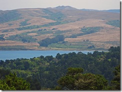
Looking Across Tomales Bay to Three PeaksSomething old and something new!

We’ll hike from (but not meet at) the same parking lot on Pierce Point Road that’s just before the turn to Heart’s Desire.  Last year there were ripe huckleberries! Wetland plants like Marsh Rosemary, Ledum and Jaumea should be in bloom.

THIS IS A SHUTTLE HIKE! CALL OR E-MAIL WENDY IF YOU'RE COMING! Home: (415) 457-3949, E-mail: bdreskin@comcast.net.
 
Directions to the trailhead: Meet at the Shell Beach parking lot, not at the trailhead (we’ll carpool to it from the Shell Beach lot).

After you pass Inverness, take a right on Camino del Mar (there’s an inn on your left; it’s just where the road starts going uphill.) Follow it to the parking lot. (Click here for a MapQuest map for driving time and directions to this area from your location.)

No restrooms at trailhead; stop at the Bear Valley Visitors Center on the way if you need to powder your nose.

Meet at 9:00 am to carpool from St. Rita.

Weather forecast: As of Thursday, August 14th, the National Weather Service forecast was Patchy fog before 11am. Otherwise, partly sunny, with a high near 67. Click here for an updated forecast.

More on this hike: "G15 Pierce Point Road to Shell Beach" in the Martins' book, Hiking Marin, shows the area in which we'll be hiking. The trails are also shown on page 4 of the Tomales Bay State Park brochure. The Google Earth image below shows Heart's Desire and Shell Beaches as seen from the east side of Tomales Bay. (Click on the image to open a larger version in your Web browser).

Wednesday, August 6, 2014

AUGUST 12 - NO HIKE

Just a reminder that there is no hike next week on Tuesday, August 12th.

Our next outing with be on Tuesday, August 19th when we do the Shell Beach hike at Tomales Bay State Park.

Tuesday, August 5, 2014

Update on COM Hike Registration

The new College of Marin Community Education Website is now up and running so you can register for Fall 1 and Fall 2 hikes (and other classes) online.


Your old COM Community Ed "My Portal" username and password won't work. You will have to set up a new Profile with a new username and password, but Dick Jordan found that process quite easy.

(If you've registered for Community Ed programs online in the past, you may receive an e-mail from COM giving you a username based on your e-mail address and a temporary password. If you didn't receive such an e-mail, just set up a new Profile and create a username and password.)

If you "browse" for classes you'll find the Meandering in Marin hikes listed under "Emeritus College"/"Home & Nature"/"Marin Adventures."

You can also find our hikes by typing "Meandering in Marin" in the search box near the top right-hand side of the Website.

Note that the course number system has changed. Fall 1 Tuesday hike "Class ID" is 66 (not "CRN 85200 as was the case under the old numbering system) and Fall 2 "Class ID" is 68.

If you pay $15/year to join the "Emeritus College" you'll get a discount on the class registration fees.

You add each class to a "Cart" and then click on "Checkout" (when you'll be prompted to join the Emeritus College). The checkout process seems much faster than under the old system.

You'll receive an e-mail confirmation of class registration, a separate receipt for fee payments, an another e-mail confirming creation of your new Profile.

The new COM Community Ed Website will look familiar to you if you've taken classes through the Tamalpais Unified High School District Community Education program (MarinLearn.com).

Monday, August 4, 2014

College of Marin Hike Registration Delayed to Tuesday, August 5

According to the College of Marin Community Education Website, registration for Fall 2014 courses (including our hikes) will NOT open today, Monday, August 4th as originally scheduled.

Registration is now supposed to begin tomorrow, Tuesday, August 5th because the College has set up a new Community Ed Website, marincommunityed.com.