As we do each year, we'll wrap up the Spring College of Marin hiking series with this
Mount Tamalpais State Park hike. (
Click here  for a recap of our 2010 hike
. View photos from past hikes in the
online album).
Here's Wendy's outline for the hike: “Although last year was rainy,
some years we've seen eight species of butterflies including a brown
elfin, Western tiger swallowtail, and lots of Propertius duskywings!
Rain or shine we should see Coral Roots, Oakland Star Lily, Mount
Tamalpais Jewel Flower, and Golden Banners on this mostly shady loop
hike.
Bring a plate and utensils, and food to share for the Gourmet Final!"
Directions to trailhead:
Go south on Highway 101 to the Stinson Beach/Highway 1 exit. Go west
on Highway 1 and wind around a lot. At the top of the ridge, turn right
onto Panoramic Highway and continue to the 4-way "crossroads." Take
the middle road to Mt. Tamalpais. Continue along this road for 5-6
miles.
At the Pantoll Ranger Station the road divides. Take the upper road for
about 1 mile. The road divides again. This is Rock Spring. Park here.
Driving time from College of Marin 55 minutes. Outhouse at trailhead and
mid-way. (Carpoolers can meet at the Greenbrae Park & Ride lot
at 9:10 am).
Weather forecast: As of Friday, May 11th, the National Weather
Service forecast for the area around Rock Spring on Mt. Tam was sunny, with a high near 70. (
Click here for an updated forecast).
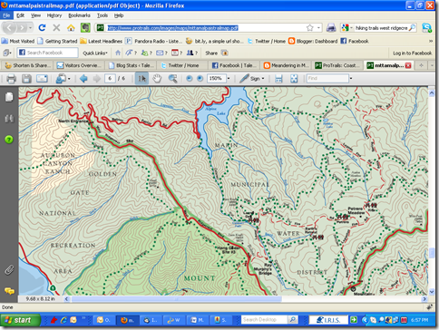
More on this hike: The "B17 Simmons - Potrero - Arturo Trails"
hike in the Martins' book, Hiking Marin, shows the trails that we'll be
hiking on, although we'll probably follow a different route (Simmons to
Benstein to Potrero Meadows to Laurel Dell and back up the Cataract
Trail to Rock Spring). Page 6 of the
state park brochure
has a trail map that shows the area. The Google Earth image below
shows were we'll be on the mountain. (Click on the photo to open a
larger image in your Web browser).


 This week we return again to West Marin. On this hike (not a loop)
we’ll explore a section of the Coastal Trail with views of Stinson
Beach and Bolinas Lagoon. When Ridgecrest Boulevard opened as a toll
road in the 1920s it was proclaimed California’s “Most Scenic Drive.”
It’s even better hiking! Clintonia could be in bloom by now! (Click here for the recap of our 2010 hike. Photos from that hike are in this on-line album.)
This week we return again to West Marin. On this hike (not a loop)
we’ll explore a section of the Coastal Trail with views of Stinson
Beach and Bolinas Lagoon. When Ridgecrest Boulevard opened as a toll
road in the 1920s it was proclaimed California’s “Most Scenic Drive.”
It’s even better hiking! Clintonia could be in bloom by now! (Click here for the recap of our 2010 hike. Photos from that hike are in this on-line album.)