Saturday, January 31, 2015

Sky Trail To Mt. Wittenberg Hike (2/3) Preview

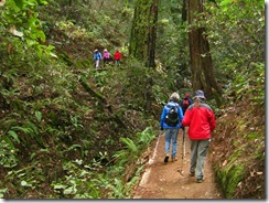
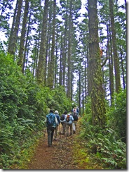
This loop has spectacular views of the estero and the ocean! (Yes, we do have to hike uphill to earn this reward). Lunch at a scenic spot on Mt. Wittenberg.

This should be a good mushroom hike.

Level and downhill after lunch.  (Click here for a recap of the hike we took on February 2, 2010. Click here for an album of photos from past hikes.)

Directions to Trailhead:  Take Sir Francis Drake Boulevard. west to Olema. Turn right on Route 1, then make an immediate left onto Bear Valley Road. Continue past the turn-off to Park Headquarters and go left on Limantour Road. Trailhead is 3.3 miles from this turn at the crest of the road. The parking lot is on your left.

50 minutes from College of Marin.

(Click here for a MapQuest map showing the approximate location of the trailhead. Click on #2 and then on "Directions" to get driving directions and estimated driving time from your location.)

There are no restrooms at trailhead, so stop at the Bear Valley Visitor Center if you need a restroom prior to the hike; there will be pit toilets at Sky Camp which we'll reach about 10:30 a.m. 

Carpoolers should depart from St. Rita's by 9:00 a.m. at the latest if driving directly to the trailhead without making a restroom stop at Bear Valley first.

(Click here to get a map with driving directions and time to St. Rita's.)

Weather forecast:  As of Tuesday afternoon, January 27th, the National Weather Service forecast for the hike was mostly cloudy, with a high near 59. (Click here for an updated forecast). 

More on this hike:  We'll do a variation on the 4.6 mile hike "G1 Sky-Horse-Z Ranch Trails" in the Martin's book, Hiking Marin. Presumably we'll do this hike in reverse, going from Junction 1 to 4, then to 3, up to the top of Mt. Wittenberg, then down to 2, and back to 1 before returning to the trailhead.  (Click here for the park's South District Hiking Map which shows these trails).

Friday, January 30, 2015

Highway 1 Reopens After Storm Damage Repairs Finshed Ahead of Schedule

(Neeta Lind Flickr Photo)
According to KTVU-TV and the San Anselmo-Fairfax Patch, Highway 1 between Panoramic Highway and Muir Beach was reopened yesterday after damage to the road caused by December storms was repaired ahead of schedule.

We encountered relatively few tourists during our hike in and around Muir Woods on Tuesday of this week, presumably because the park had temporarily banned large tour buses while Highway 1 was closed, leaving the narrow, winding road that descends to the park from Panoramic Highway as the only vehicle access. That ban appears to have been lifted following the reopening of Highway 1.


Saturday, January 24, 2015

Steep Ravine Trail Closure; Details on Winter 2015 Hikes Now Online!

The Steep Ravine trail was damaged during the December storms. Although the Mount Tamalpais State Park Website says that the trail will remain closed through January, it now appears that the trail will not reopen until late March or early April.

Because of that trail closure, our annual Steep Ravine-Dispsea Trail hike will not take place on Tuesday, February 24th as originally planned, and as noted on the hike list that Wendy previously sent out via e-mail.

Updated, detailed information on all hikes during the Winter 2015 College of Marin session (January 27-March 10) is now online. Click here to view and print out that information.

Note that this list indicates that the Steep Ravine hike has been cancelled, and that the location of the February 24th hike will be announced at a later date.


Wednesday, January 21, 2015

Muir Woods (Dipsea to Ben Johnson) Hike (1/27) Preview

Having It Both Ways On the Hillside Trail We'll kick off the Winter 2015 hiking series by heading south in the County and back into the federal parklands at Muir Woods to do a hike that only Wendy showed up for when it was scheduled for December 2, 2014.

Here's Wendy's description of the hike: "Instead of racing up the Dipsea, we’ll stop to admire ancient redwoods, beautiful views, and hopefully some mushrooms."  (Click here to read the recap of our 2/10/09 hike on these trails. You can view photos taken on previous hikes.)

Directions to trailhead: From Highway 101 take the Stinson Beach exit, turn left (west) on Shoreline Highway, right on Panoramic Highway and left on Muir Woods Road. Meet at Muir Woods Parking Lot #2, which is the one farthest from the park entrance station.

Click here for a MapQuest map that shows the approximate location of the parking lot. Click on #1 to get driving directions and time from your location.

Time: 35 minutes from College of Marin. Restrooms at trailhead.

Carpoolers can meet at the Greenbrae Park & Ride lot near the intersection of Sir Francis Drake Boulevard and Highway 101 at 9:10 a.m.

Weather forecast: As of Wednesday, January 21st, the National Weather Service forecast for the hike was mostly cloudy, with a chance of showers, and a high near 65. (Click here for an updated forecast).

More on this hike: We'll hike up the Dipsea Trail, then descend back to the floor of Muir Woods on the Ben Johnson Trail. (Click here to view and download the park trail map). If you have Tracy Salcedo-Chourre's book, Exploring Point Reyes National Seashore and Golden Gate National Recreation Area, you'll see that she proposes hiking this route in the reverse direction (up the Ben Johnson, down the Dipsea) from our plan, but her book will at least give you an idea of what our hike will be like.

Friday, January 16, 2015

Road Work Near MMWD Corte Madera Office

If you're like Dick Jordan, who thought that during the last two weeks of January he'd just drop by the MMWD office in Corte Madera during business hours on weekdays and buy a new MMWD Watershed pass before his expired at the end of the month, think again.


The Central Marin Police Agency says that due to road work near the MMWD office, between 9 am and 5:00 pm through January 31st, ONLY ONE LANE of Tamal Vista Boulevard (the main north-south street the parallels Highway 101) will be open from Lucky Drive (the southbound freeway exit that you'd take to get to the MMWD office) and Wornum Drive (the street to the north of the MMWD and which runs under the freeway, and onto which you'd normally exit from MMWD's parking lot). (The police couldn't tell Dick if the road work would take place on weekends as well as weekdays).

In theory (but perhaps not in practice), you might be able to exit the freeway at Lucky Drive, immediately turn left on to Nellen Avenue (which is between 101 and Tamal Vista), and sneak into the MMWD lot that way.

In any event, traffic is likely to be backed up at the Lucky Drive exit, making your trip to MMWD longer than usual.
The MMWD Website says that if you decide to pay for your pass online: "Your parking pass(es) will be mailed to you when your credit card transaction has been completed and approved. Your receipt can be used in place of your new parking pass for two weeks after purchase."

Thursday, January 15, 2015

Alpine Dam to Bon Tempe Dam Hike (1/20) Preview

We hike along a creek with lovely cascades and ferns. This is usually an interesting mushroom hike – in past years we've seen Toothed Jelly Fungus, Rosy Gomphidius, Cowboy's Handkerchief, and The Prince! The start is uphill with some stairs (but we’ll find lots to look at on the way), the end is level - and in between it’s up and down!

We end up at the Bon Tempe Dam.  (Click here for a recap of our January 2010 hike). Note the early start time (9:15 am). Carpool leaves St. Rita Church in Fairfax at 8:55 a.m. We sometimes get back late on this hike. If you must be back at 1:45 pm it's safer to skip this one.

This is a shuttle hike, so CALL WENDY AT 457-3949 or send her an e-mail her at bdreskin@comcast.net if you are coming! 

Directions to trailhead:  Take the Fairfax-Bolinas Road. Turn in as you would to go to Lake Lagunitas.

After the ranger station at Sky Oaks (but before Shaver Grade) there is an unpaved road to the right. Take this to Lake Bon Tempe and park at the lot near the foot of the dam.  

Click here for a MapQuest map that shows the parking lot at Bon Tempe Dam. Click on #1 to get driving times and directions from your location.

MEET HERE AT 9:15 a.m. Porta potties are in the parking lot. From here we’ll carpool to the trailhead (near Alpine Dam).

We’ll need people who are not in a rush to take the driver’s back to their cars parked near Alpine Dam.

Do not pay the $8 day use fee at the Sky Oaks entrance if you plan to take people to the trailhead.

If you are going to leave your car in the lot by Bon Tempe Dam, stop at the two automated pay station machines which are now at the parking area on the right just beyond the entrance station and pay the day use fee unless have an MMWD Watershed pass.

You can use $1, $5, or $10 bills or Visa, Mastercard, Discover and American Express credit cards. (Note that on our November 18th Sky Oaks hike some Meanderers had difficulty getting the pay station machines to accept a credit card with a chip.) Change is not given, coins and $20 bills aren't accepted.

Annual entrance passes to the MMWD Watershed are $60 ($30 for those 62 and older) for Marin resdients, $100 for out-of-county residents of all ages.

It doesn't appear that you can purchase an annual pass from the new automated pay station machines. You can buy one online or by sending a check to MMWD and it will be mailed to you, or you purchase one in person at the MMWD office at 220 Nellen Avenue in Corte Madera, on the west side of Highway 101(take the southbound Lucky Drive exit). (If you purchased a pass in 2014, check the expiration date to see if it has expired.)

Weather forecast:  As of Thursday, January 15th, the National Weather Service forecast for this area during the hike was mostly sunny, with a high near 61. (Click here for an updated forecast).

More on this hike: There is no comparable hike in the Martins' book, Hiking Marin, but we'll begin our hike just past the dam at Alpine Lake and head east on the Helen Markt Trail, eventually pick up one of the fire roads, and wind our way back to Bon Tempe Lake. (Click here to view, zoom in on, or print a map of the MWWD watershed lands).

Thursday, January 8, 2015

Sky Trail to Bear Valley Hike (1/13) Preview

Uphill Slog - Sky Trail We return to Point Reyes National Seashore on Tuesday, January 13th for our the first "Winterim" outing of 2015.

(The last "Winterim" hike will be the following Tuesday, January 20th. The first hike of the Winter 2015 College of Marin series will be on January 27th, so if you've haven't as yet registered for that class, be sure to do so now.)

The trail is about 7.3 miles long, but a lot of it is fairly level, so the hike is a bit easier than the distance implies.  

This is a shuttle hike, so CALL WENDY AT 415-457-3949 or 415-517-0488 or send her an e-mail her at bdreskin@comcast.net if you are coming! 

Note the earlier than usual meeting time at Bear Valley.

Directions to trailhead: We’ll meet at Bear Valley at 9:20 a.m. and carpool to Sky Trail.

(Click here for a MapQuest map showing the trailhead location; click on #1 to get driving directions and estimated travel time from your location). 

When we get to Mt. Wittenberg we’ll go down Old Pine to the Bear Valley Trail (which is always soggy, whether it has rained recently or not, so waterproof your boots!

We’ll need some people who are not in a rush to drive people back to Sky Trail after we reach the Bear Valley Visitor Center and parking lot.

Restrooms at Bear Valley, none at Sky Trail trailhead, but some as we pass Coast Camp.

Carpool leaves St. Rita Church in Fairfax at 8:45 a.m.

Weather forecast: As of Thursday, January 8th, the National Weather Service forecast for the hike was sunny, with a high near 56.  (Click here for an updated forecast).

More on this hike:  "G3 Sky Trailhead to Bear Valley" in the Martins' book, Hiking Marin, is a version of this hike although we usually go straight at Junction #1 shown on their map and continue on to Sky Camp rather than take the detour up to Mt. Wittenberg (which we do on a separate loop hike from the Sky Trail trailhead) and then back down to the Sky Trail before continuing on to the Old Pine Trail, Divide Meadow and on to Bear Valley.  (Click here for the Seashore's South District Hiking Map which shows these trails).

The following Google Earth image gives a bird's eye view of where we'll be hiking:


Monday, January 5, 2015

Time - Water - Energy: Artist Hugh Pocock

While we're not hiking as a group this week, here's a chance for us to look at some familiar scenery, thanks to the following video produced by colleagues of Dick Jordan, the staff and members of the Community Media Center of Marin (cmcm.tv), for airing on MarinTV.

 
( Click here if the YouTube video player does not display)

Sunday, January 4, 2015

SF Bay Area: What Might Have Been

While we spend a good part of the year hiking in and around Point Reyes National Seashore, most of us probably rarely think what West Marin would have looked like if planned highway, commercial, and residential development would have taken place.


But as this story from today's Marin I-J reminds us, changes not only to Point Reyes, but the entire San Francisco Bay Area, are chronicled in a new Website: SF Bay Area: What Might Have Been

Steep Ravine Trail Closed

The January 4, 2015 edition of the Marin I-J reported that due to a bridge being out and downed trees the Steep Ravine trail has been closed until further notice, and probably through the end of the month.

(Theresa Fisher Photo From Our 2014 Hike)
January 24, 2015 Update: Although the Mount Tamalpais State Park Website (http://www.parks.ca.gov/?page_id=471) says that the trail will remain closed through January, it now appears that the trail will not reopen until late March or early April.

In view of that trail closure, the Steep Ravine-Dipsea Trail hike originally scheduled for Tuesday, February 24th, will not take place.

Wendy will pick a different location for our hike on that last Tuesday in February.