(Click here if the video player doesn't appear)
Friday, May 29, 2015
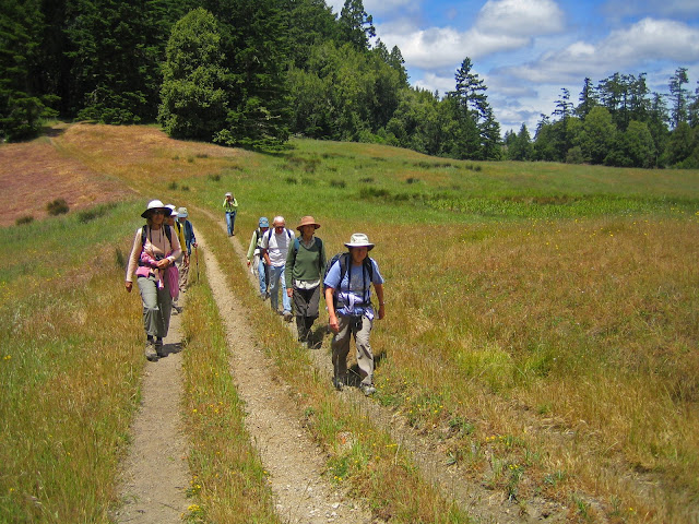
Bolinas Ride Hike Video Now Online!
Here's what the beginning of this Tuesday's Bolinas Ridge hike was like.
(Click here if the video player doesn't appear)
(Click here if the video player doesn't appear)
Thursday, May 28, 2015
Abbott's Lagoon Hike (6/2) Preview
 This week we continue our summer hiking strategy of staying near the coast with another trip to Point Reyes National Seashore.
Here's Wendy's description for this outing: "On this lovely level walk we should see Yellow Sand Verbena, Dune Primrose, Giant Coastal Hedge Nettle, Cogweb Thistle, Heliotrope, Point Reyes Checkerbloom and more! Some years we've seen endangered Snowy Plovers, a Sora, and an Osprey carrying a fish! We also saw endangered Bumblebee Scarab Beetles, Tiger Beetles, and a Point Reyes Blue butterfly! Lunch on the beach." (Click here for a recap of the June 2009 hike).
Directions to the trailhead: Take Sir Francis Drake Boulevard. Turn right at Olema and make an immediate left onto Bear Valley Road. (Stop at the park visitor center at Bear Valley to use the restrooms if you don't want to wait to use the pit toilet at the trailhead.)
Continue until you pick up Sir Francis Drake again. Go through Inverness.
After you top Inverness Ridge and head down the other side, the road splits: Going left takes you the wrong way and you'll head out to Drake's Beach and the lighthouse. You want to bear to the right (Wendy says "Go straight") onto Pierce Point Road.
Pass Tomales Bay State Park. The parking area for Abbott's Lagoon will be on your left. (Click here for a MapQuest Map that will show the location of the trailhead; click on #1 for driving directions and time.)
Carpool from St. Rita at 8:45 am. Restrooms at trailhead.
Weather forecast: As of Thursday, May 28th, the National Weather Service forecast was sunny, with a high near 58. (Click here for an updated NWS forecast. For real time weather conditions, updated every 10 minutes, at the RCA field just south of Abbott's Lagoon, click here.)
More on this hike: "G16 -Beach and Lagoon Trails" from the Martin's book, Hiking Marin, shows the trails in this part of the seashore, as does Tracy Salcedo-Chourre's Exploring Point Reyes National Seashore and Golden Gate National Recreation Area. Both books have a 3.0 mile hike at Abbott's Lagoon, although our route could be different since you can roam off-trail rather far and wide, up and down the beach, and around the upland areas. (Click here to view and print the seashore's North District Hiking Map which shows the location of the roads, trailhead, and trails).
The following Google Earth image shows the area where we'll be hiking. (Click on the image to open a larger version in your Web browser).

Wednesday, May 20, 2015
Bolinas Ridge to S.P. Taylor Hike (May 26) Preview
 |
| Looking West from Bolinas Ridge (S. Walker photo) |
We could hear Meadowlarks singing, and see Lorquin’s Admirals and Western Tiger Swallowtails.
Directions to Trailhead:
Meet at Samuel P. Taylor State Park at 9:30 am.
Unless you have a State Park Pass, pay the $8.00 day use fee/parking if you leave your car there.
We’ll carpool to the Bolinas Ridge trailhead and hike back down.
Click here for a Mapquest Map showing the parking lot at Samuel P. Taylor. Click on #1 for driving times and directions from your location.
Carpool leaves from St. Rita at 9:10 a.m.
Restrooms at Samuel P. Taylor, none at trailhead.
THIS IS A SHUTTLE HIKE SO CALL OR E-MAIL WENDY IF YOU'RE COMING: Home phone: 415 457-3949; cell 415 517-0488; E-mail: bdreskin@comcast.net.
Weather forecast: As of Wednesday, May 20th, the National Weather Service forecast was partly sunny, with a high near 65. (Click here for an updated forecast).
More on this hike: "H8 - Taylor State Park to Bolinas Ridge" in the Martin's book, Hiking Marin, is a 10.2 mile loop hike which starts and ends in the state park. We're doing this hike in the opposite direction, but only one-way, from the trailhead on the south side of the road where Sir Francis Drake Boulevard reaches a crest between the McIsaac Ranch at Tocoloma (intersection of SFD and Platform Bridge Road) and Olema, so our total distance hiked should be more like 5 miles.
Although part of the area is within the GGNRA, it is actually administered by Point Reyes National Seashore. The Point Reyes Hiking Map (South District) shows the trails that we'll be following within the GGNRA.
The Google Earth image below shows the area where will be hiking viewed from just east of Olema toward Samuel P. Taylor State Park. Sir Francis Drake Boulevard is the yellow line snaking through the picture. You can see the trail beginning right off to the road on the right. (Click on the image to open a larger view in your Web browser).

Wednesday, May 13, 2015
Bear Valley to Five Brooks Shuttle Hike (5/19) Preview
We begin our "Summer at the Seashore" series of hikes this week by starting at the Bear Valley Visitor Center in Point Reyes National Seashore and hiking south to Five Brooks. (Here's the recap from the June, 2009 trek.)
Here's Wendy's description of the outing:
"We’ll start by checking out dragonflies and birds on the pond at Five
Brooks, then carpool to Bear Valley.
outing:
"We’ll start by checking out dragonflies and birds on the pond at Five
Brooks, then carpool to Bear Valley.
"In past years we've seen Satyr Commas, Acmon Blues, Field Crescents, California Tortoise Shells, Pale Swallowtails, Western Tiger Swallowtails, and dragonflies including Cardinal Meadowhawks, Western Pondhawks, and Eight Spotted Skimmers.
"This level hike takes us through Vedanta Retreat and Stewart Ranch back to Five Brooks."
Here's Wendy's description of the
outing:
"We’ll start by checking out dragonflies and birds on the pond at Five
Brooks, then carpool to Bear Valley."In past years we've seen Satyr Commas, Acmon Blues, Field Crescents, California Tortoise Shells, Pale Swallowtails, Western Tiger Swallowtails, and dragonflies including Cardinal Meadowhawks, Western Pondhawks, and Eight Spotted Skimmers.
"This level hike takes us through Vedanta Retreat and Stewart Ranch back to Five Brooks."
THIS IS A SHUTTLE HIKE (CALL OR E-MAIL WENDY IF YOU'RE COMING: Home: 415 457-3949 E-mail: bdreskin@comcast.net).
Directions to trailhead: We'll meet at Five Brooks at 9:30 a.m. Take Sir Francis Drake to Olema, turn left onto Highway 1, and continue south until you see the right hand turn off the highway to Five Brooks. We'll leave some cars at Five Brooks, so we'll need some drivers not in a hurry to head home after the hike to drive those who left their cars at the trailhead back to Five Brooks.
Click here for a MapQuest map that shows the location of the trailhead. Click on #1 to get driving time and directions from your location.
Restrooms (porta-potties) at Five Brooks and (real-deal flush toilets) at Bear Valley.
Carpool from St. Rita's at 8:55 a.m.
Weather forecast: As of Wednesday, May 13th, the National Weather Service forecast for the hike was partly sunny, with a high near 63. (Click here for an updated forecast).
More on this hike: Hike "F8 Five Brooks Trailhead to Bear Valley" in the Martins' book, Hiking Marin, does this 4.4 mile hike in the reverse direction from our trek. Our route will roughly parallel the San Andreas Fault which splits the Olema Valley down its middle.
After about a mile and a half we'll begin to cross the 2,000 acre parcel owned by the Vedanta Society of Northern California. Later we'll skirt the the historic Stewart Ranch. This trail is popular with equestrians, and we're likely to encounter horses and cattle along the way.
The elevation change is only 350' over the length of the trail, and many sections are quite flat or downhill. (Click here to view the Rift Zone Trail on the park's South District Hiking Map).
The Google Earth image below gives you a bird's eye view of the route will follow; the Bear Valley parking lot is at the far right, and "Mill Pond" at the far left is at Five Brooks. The yellow line marked "Shoreline Highway" is Highway 1. (Click on the image to enlarge it in your Web browser).
Monday, May 11, 2015
On Safari in Tanzania, Easy and "On The Cheap"
Interested in going on safari in Tanzania but you don't quite have the cash-on-hand to finance the trip?
"No worries," as the Australians say.
Just sign up for the repeat presentation of Wendy's "Armchair Safari: Preparing for a Trip to Tanzania" virtual trip which will be held every Monday evening from 7:10-8:30 p.m. at the College of Marin Kentfield campus from June 15th through July 20th. Cost is $76, BYOW ("Bring Your Own Wildlife").
Here's the course description:
 |
Just sign up for the repeat presentation of Wendy's "Armchair Safari: Preparing for a Trip to Tanzania" virtual trip which will be held every Monday evening from 7:10-8:30 p.m. at the College of Marin Kentfield campus from June 15th through July 20th. Cost is $76, BYOW ("Bring Your Own Wildlife").
Here's the course description:
"Do you dream of going on a safari and seeing the Great Migration? Whether you have already started planning to make this dream come true, or you would like to join an "armchair safari" and learn about the mammals and birds of East Africa, this class is for you. From antelopes to zebras, learn about animals' habitats, evolution, life histories, special adaptations, social structure, migratory patterns, and current conservation status and risks. Class will focus on animals and birds that people would be likely to see on a safari in Tanzania."Registration opens today and you can sign up online.
Wednesday, May 6, 2015
Rock Spring "Final Exam" Hike (5/12) Preview
As we do each year, we'll wrap up the Spring College of Marin hiking series with this Mount Tamalpais State Park hike. (Click here for a recap of our 2010 hike. View photos from past hikes in the online album).

Here's Wendy's outline for the hike: "We should see Coral Roots (a native orchid), Meadow Rue, and Golden Banners on this mostly shady loop hike."
Bring a plate and utensils, and food to share for the Gourmet Final!"
Directions to trailhead: Go south on Highway 101 to the Stinson Beach/Highway 1 exit. Go west on Highway 1 and wind around a lot. At the top of the ridge, turn right onto Panoramic Highway and continue to the 4-way "crossroads." Take the middle road to Mt. Tamalpais. Continue along this road for 5-6 miles.
At the Pantoll Ranger Station the road divides. Take the upper road for about 1 mile. The road divides again. This is Rock Spring. Park here. (Click here for a MapQuest map showing the trailhead and giving driving time and directions from your location.)
Driving time from College of Marin 55 minutes.
Carpoolers can meet at Greenbrae Park & Ride lot at 9:10 a.m. (Click here for a MapQuest map showing the parking lot; click on #1 to get driving time and directions from your location.)
Outhouse at trailhead and mid-way.
Weather forecast: As of Wednesday, May 6th, the National Weather Service forecast for the area around Rock Spring on Mt. Tam was mostly sunny, with a high near 65.. (Click here for an updated forecast).
More on this hike: The "B17 Simmons - Potrero - Arturo Trails" hike in the Martins' book, Hiking Marin, shows the trails that we'll be hiking on, although we'll probably follow a different route (Simmons to Benstein to Potrero Meadows to Laurel Dell and back up the Cataract Trail to Rock Spring). Page 6 of the state park brochure has a trail map that shows the area.
Here's the hike profile and route we'll follow.

The Google Earth image below shows were we'll be on the mountain. (Click on the photo to open a larger image in your Web browser).
Monday, May 4, 2015
May, Early June Hike Information Online!
Tuesday Interim Hikes
Our week-by-week Tuesday summer interim hikes begin on May 19th with a one-way trek from Bear Valley to Five Brooks.
Click here for detailed information on these five hikes through June 9th.
Information on Tuesday hikes from June 16th through August will be available at the end of May.
Monday Interim Hikes
Can't make it on Tuesdays? Weekly hikes will be held on these Mondays:
Monday College of Marin Meanders
From June 15th through July 20th, Wendy will also be leading a series of Monday Meandering hikes offered through the College of Marin. Registration for those hikes opens on May 11.
Our week-by-week Tuesday summer interim hikes begin on May 19th with a one-way trek from Bear Valley to Five Brooks.

Click here for detailed information on these five hikes through June 9th.
Information on Tuesday hikes from June 16th through August will be available at the end of May.
Monday Interim Hikes
Can't make it on Tuesdays? Weekly hikes will be held on these Mondays:
- May 18 - Lake Bon Tempe, Rocky Ridge (Meet at Bon Tempe Dam parking lot at 9:45 a.m.)
- May 25 - No hike
- June 1 - Angel Island (Meet at Tiburon ferry dock in time to catch 10 a.m. boat)
- June 8 - Bear Valley to Five Brooks (Meet at Five Brooks at 9:30 a.m.)
Monday College of Marin Meanders
From June 15th through July 20th, Wendy will also be leading a series of Monday Meandering hikes offered through the College of Marin. Registration for those hikes opens on May 11.
Subscribe to:
Posts (Atom)