Friday, December 29, 2017

Reminder - No hike on Monday or Tuesday, January 1 and 2, 2018

Just a quick reminder that there will be no hikes this coming Monday or Tuesday, January 1 or 2, 2018.

The next scheduled Tuesday hike is January 16, 2018 at Pine Mountain/Elliott Nature Preserve.


Happy New Year to all.

Winter Hiking Series Signup Starts Tuesday January 2, 2018


Registration for Winter 2018 College of Marin Hiking Series opens next Tuesday, January 2nd.  

You can sign up: 
  •  Online 
  • By phone (415 455-9305)
  • By U.S. mail (print out and complete registration form and mail to Community Education, 835 College Avenue, Kentfield, CA 94904)
  • Or in-person (Mon-Thurs 9 a.m. - Noon, 1-4 p.m., Fri 9 a.m. - Noon) at the Kentfield campus (Student Services Building, Room 145) or Indian Valley campus (Building 7, Room 194)
Here's the class information for both the Monday and Tuesday hikes:

Monday Hikes

Course No: EC 3197
7 Mondays, Jan 29 - March 19
Time: 9:45 a.m. - 1:45 p.m.
Fee: $155/ESCOM members pay $131

Tuesday Hikes

Course No: EC 3198
7 Tuesdays, Jan 30 - March 13
Time: 9:45 a.m. - 1:45 p.m.
Fee: $155/ESCOM members pay $131

If you want to sign up for other College of Marin Community Education courses, click here to view and download a copy of the Winter 2018 Course Schedule.

Happy Trails to You!

Friday, December 22, 2017

Reminder - No Hike Tuesday December 26, 2017

Just a quick reminder that there will be no hike this coming Tuesday, December 26, 2017.

The next scheduled Tuesday hike is January 16, 2018 at Pine Mountain/Elliott Nature Preserve.

Also, there is no hike on Monday, December 25, 2017.

Happy Holidays to all.

Sunday, December 17, 2017

REMINDER- No Hike Tuesday December 17, 2017

Just a quick reminder that there will be no hike this coming Tuesday, December 17, 2017.

The next scheduled Tuesday hike is January 16, 2018 at Pine Mountain/Elliott Nature Preserve.

Wendy is offering a shuttle hike this Monday, December 18, 2017, Pine Mountain/Elliott Nature Preserve. Please note the early start time and late finish time.

Wendy says: "This hike starts in chaparral and passes by serpentine areas.  We go through the pygmy Sargent cypress forest, and return through oak/bay/madrone woodland. We'll check out birds and mushrooms as we go. 
     We need people to meet at the end of Cascade Dr. Fairfax  at 9:20. If you have time pressure after class go there as well, since the car shuttle won’t get people back to the start until about 3:20.  I will drive the drivers from Cascade to the start of the hike. Others, meet at the trailhead. 
        Take the Bolinas-Fairfax Road past the Meadow Club (golf course) and keep going. Park in the parking lot across from the Pine Mountain Fire Rd.  It is a large dirt parking lot on your left, and the fire road is on the right. If you start going downhill and can see Lake Alpine, you’ve gone too far.
      25 minutes from College of Marin."

Friday, December 8, 2017

Alpine Dam to Bon Tempe (12/12/17) Preview Shuttle Hike, Early Start

We hike along a creek with lovely cascades and ferns. This is usually an interesting mushroom hike – in past years we've seen Toothed Jelly Fungus, Rosy Gomphidius, Cowboy's Handkerchief, and The Prince! The start is uphill with some stairs (but we’ll find lots to look at on the way), the end is level, and in between it’s up and down!

We end up at the Bon Tempe Dam.  (Click here for a recap of our January 2010 hike). Note the early start time (9:20 am). Carpool leaves St. Rita Church in Fairfax at 8:55 a.m. We sometimes get back late on this hike. If you must be back at 1:45 pm it's safer to skip this one.

This is a shuttle hike, so CALL WENDY AT 457-3949 or send her an e-mail her at bdreskin@comcast.net if you are coming! 

Directions to trailhead:  Take the Fairfax-Bolinas Road. Turn in as you would to go to Lake Lagunitas.

After the ranger station at Sky Oaks (but before Shaver Grade) there is an unpaved road to the right. Take this to Lake Bon Tempe and park at the lot near the foot of the dam.  

Click here for a map that shows the parking lot at Bon Tempe Dam. Click on #1 to get driving times and directions from your location

MEET HERE AT 9:20 a.m. Porta potties are in the parking lot. From here we’ll carpool to the trailhead (near Alpine Dam).

We’ll need people who are not in a rush to take the driver’s back to their cars parked near Alpine Dam.

Do not pay the day use fee at the Sky Oaks entrance if you plan to take people to the trailhead. 

If you are going to leave your car in the lot by Bon Tempe Dam, stop at the two automated pay station machines which are now at the parking area on the right just beyond the entrance station and pay the $8 day use fee unless have an MMWD Watershed pass.

You can use a credit card, $1, $5, or $10 bills (but not coins or $20 bills) at the automated pay station which will not give you change if you overpay.

Annual watershed area parking passes for Marin residents are $60 ($30 for those 62 and older). You can buy them online or at the MMWD main office in Corte Madera
 

Weather forecast:  As of Tuesday, December 13th, the National Weather Service forecast for this area during the hike was mostly sunny, with a high near 553. (Click here for an updated forecast).

More on this hike: There is no comparable hike in the Martins' book, Hiking Marin, but we'll begin our hike just past the dam at Alpine Lake and head east on the Helen Markt Trail, eventually pick up one of the fire roads, and wind our way back to Bon Tempe Lake. (Click here to view, zoom in on, or print a map of the MWWD watershed lands)

Tuesday, December 5, 2017

"Flying Up" Cascade Falls

Marin filmmaker, Gary Yost, is noted for his short films featuring Mount Tam, some of which have been featured in past posts to the Meandering blog.


In one of his latest film projects, Gary used a small drone outfitted with a video camera to fly up and down and around Cascade Falls near Mill Valley. (Note: This post originally indicated it was filmed around the falls of the same name near Fairfax.)


 (Click here if you don't see the Vimeo video player)

Former Meandering blogmaster, Dick Jordan, who posted this from his home in Eugene, Oregon, doesn't own a drone. But here's one of his short films shot on a wintry day in the last week of April of 2017 at Salt Creek Falls, the second highest waterfall in Oregon.


 (Click here if you don't see the Vimeo video player)

Dick produced another short film about the McKenzie River. He has submitted excerpts from that for possible inclusion in a film that will be shown at the "The Four Seasons of the McKenzie River" concert set to the music of Vivaldi's "The Four Season" to be performed by the Eugene Symphony in mid-February.

Monday, December 4, 2017

Correction to date - Winterim Hiking Schedule 2018/2019


Until the Winter College of Marin series of hikes begin, Wendy will be running a series of by-the-week one-way shuttle hikes. UNLIKE CLASSES THROUGH COM, RAIN CANCELS!  $22/class. Wendy says: "Please email or call to let me know if you will be there since these are shuttle hikes, and also so I can let you know if there is a rain cancellation.  In case of questionable weather, look for an email around 7 AM."


Here are the dates for both Monday and Tuesday hikes:


  • December 11 - NO HIKE
  • December 12 - Lake Alpine
  • December 18 - Pine Mountain to Elliott Nature Preserve
  • December 19 - NO Hike
  • December 25 and 26 - NO HIKE
  • January 1 and 2 - NO Hike
  • January 2 - Register for Winter Semester
  • January 8 - Lake Alpine
  • January 9 - NO HIKE
  • January 15 - NO HIKE
  • January 16 - Pine Mountain/Elliott Preserve
  • January 22 - Sky Oaks to Deer Park
  • January 23 - Sky Oaks to Deer Park "Final Exam" 
  • Details follow.


    MONDAY WINTERIM 2017-2018

    December 11  NO HIKE

    DECEMBER 18 Pine Mountain to Elliott Nature Preserve

    SHUTTLE HIKE

    NOTE EARLY START TIME AND LATE FINISH TIME

          This hike starts in chaparral and passes by serpentine areas.  We go through the pygmy Sargent cypress forest, and return through oak/bay/madrone woodland. We'll check out birds and mushrooms as we go. 
         We need people to meet at the end of Cascade Dr. Fairfax  at 9:20. If you have time pressure after class go there as well, since the car shuttle won’t get people back to the start until about 3:20.  I will drive the drivers from Cascade to the start of the hike. Others, meet at the trailhead. 
            Take the Bolinas-Fairfax Road past the Meadow Club (golf course) and keep going. Park in the parking lot across from the Pine Mountain Fire Rd.  It is a large dirt parking lot on your left, and the fire road is on the right. If you start going downhill and can see Lake Alpine, you’ve gone too far.
          25 minutes from College of Marin.

    JANUARY 2 REGISTER FOR WINTER SESSION AT COM 

    JANUARY 8  LAKE ALPINE

    SHUTTLE HIKE

         We hike along a creek with lovely cascades and ferns.  This is usually an interesting mushroom hike as well. The start is uphill with some stairs (but we’ll find lots to look at on the way), the end is level - and in between it’s up and down!  We end up at the Bon Tempe Dam.  We may get back late (about 3 PM) so this is not a good hike for you if you have to be back at 1:45. 
         Take the Fairfax-Bolinas Rd. Turn in as you would to go to Lake Lagunitas. After the ranger station at Sky Oaks (but before Shaver Grade) there is an unpaved road to the right. Take this to Lake Bon Tempe and park. We’ll carpool to the trailhead. Do not pay if you plan to take people to the trailhead.  We’ll need people who are not in a rush to take the drivers back to their cars.
          Portables are in the parking lot for Lake Bon Tempe.

    JANUARY 15  NO CLASS for MLK Day

    JANUARY 22  SKY OAKS TO DEER PARK  SHUTTLE HIKE

                Mostly downhill and level!  If we haven't seen the first milkmaid of the season, we should see it today! We might even see the first Hound's Tongue.
                Meet at Deer Park to carpool.  Take Bolinas Ave in Fairfax, turn left on Porteous. (If you see Deer Park Villa you’ve gone a bit too far, turn around.) Go to the parking lot at the end. Drivers leave food in cars at Deer Park.  Restrooms at Deer Park and Sky Oaks, and portable en route.  20 minutes from College of Marin.  


    TUESDAY WINTERIM 2017-2018
    UNLIKE CLASSES THROUGH COM, RAIN CANCELS!  $22/class. Please email or call to let me know if you will be there since these are shuttle hikes, and also so I can let you know if there is a rain cancellation.  In case of questionable weather, look for an email around 7 AM. 

    DECEMBER 12  LAKE ALPINE

    SHUTTLE HIKE

          We hike along a creek with lovely cascades and ferns.  This is usually an interesting mushroom hike as well. The start is uphill with some stairs (but we’ll find lots to look at on the way), the end is level - and in between it’s up and down!  We end up at the Bon Tempe Dam.  We may get back late (about 3 PM) so this is not a good hike for you if you have to be back at 1:45. 
         Take the Fairfax-Bolinas Rd. Turn in as you would to go to Lake Lagunitas. After the ranger station at Sky Oaks (but before Shaver Grade) there is an unpaved road to the right. Take this to Lake Bon Tempe and park. We’ll carpool to the trailhead. Do not pay if you plan to take people to the trailhead.  We’ll need people who are not in a rush to take the drivers back to their cars.
          Portables are in the parking lot for Lake Bon Tempe.

    JANUARY 2 REGISTER FOR WINTER SESSION AT COM 

    JANUARY 9  NO  HIKE 

    JANUARY 16  PINE MOUNTAIN/ELLIOTT NATURE PRESERVE
          This hike starts in oak/bay/madrone woodland, passes through chaparral, then heads down to a valley with a stream, passing some serpentine rock areas. We'll check out birds and mushrooms as we go. Little Carson Falls is a detour which is steep in parts and can be slippery if it rains. We may or may not go to the falls depending on the group’s decision. Due to a lack of good places to stop on the Repack fire road, lunch will be early (around 11:30) or late (around 1).
                We need two people to meet at the end of Cascade Dr.in Fairfax  at 9:20. If you have time pressure after class go there as well, since the car shuttle won’t get us back until a little after 2PM.  I will drive those drivers to the start of the hike. Others, meet at the trailhead.  Take Sir Francis Drake Blvd to Fairfax. Turn left at the first gas station, and make an immediate right in front of the movie theater. Turn right on Bolinas Ave..  Drive 2.6 miles to pass the Meadow Club and continue on for 1.3 miles until the top of the ridge.  Park in the large gravel parking lot on the left side of the road.  If you start going downhill and see Lake Alpine you've gone too far.

                No restrooms. 25 minutes from College of Marin.
    and set your odometer and go 3.2 miles.  There are pull-outs on the right and left as you round a bend. No restrooms. 25 minutes from College of Marin. 

    JANUARY 23  SKY OAKS TO DEER PARK  FINAL EXAM!

                Mostly downhill and level!  If we haven't seen the first milkmaid of the season, we should see it today! We might even see the first Hound's Tongue!
                Meet at Deer Park to carpool.  Take Bolinas Ave in Fairfax, turn left on Porteous. (If you see Deer Park Villa you’ve gone a bit too far, turn around.) Go to the parking lot at the end. Drivers leave food in cars at Deer Park.  Restrooms at Deer Park and Sky Oaks, and portable en route.  20 minutes from College of Marin.  


  • Sunday, December 3, 2017

    Lake Lagunitas, MMWD (12/5/2017) Preview


    We return to the MMWD watershed for our final hike of the 2017 Fall "2" session.

    Here's what Wendy says we'll be doing:  "We make a partial circle around the lake, looking for Ring-Neck ducks, Mergansers, Grebes and other birds, and then make a loop past Pilot Knob, returning on Southern Marin Line. We usually see newts and some interesting mushrooms on this hike."

    "Bring your contribution to our gourmet feast, plus a plate, utensils, and a cup." (Click here for a recap of our December 2009 "Final Exam" hike at this location or click here for photos from past hikes.)

    Directions to trailhead: Take Sir Francis Drake Boulevard into Fairfax. Turn left on Pacheco and make an immediate right in front of the movie theater onto Broadway. The first left puts you on Bolinas Avenue. Follow this until you see the sign on your left for Lake Bon Tempe and Lake Lagunitas, Sky Oaks Rd. Follow the road to the old toll booth by Sky Oaks Ranger Station.

    Click here for the MMWD map and directions. Or click here for a Google Maps map showing the trailhead location; click on the teardrop icon to get driving directions and estimated travel time from your location.

    Unless you have an MMWD pass, continue past the old toll booth, pull over at the parking area on the right and pay the day use fee, and then continue driving until you reach the end of the road.

    The day use fee is $8.  You can use a credit card, $1, $5, or $10 bills (but not coins or $20 bills) at the automated pay station which will not give you change back if you overpay.

    Annual watershed area parking passes for Marin residents are $60 ($30 for those 62 and older). You can buy them online or at the MMWD main office in Corte Madera.

    Time: 30 minutes from College of Marin. Outhouse in parking lot.

    Carpoolers can meet at St. Rita's Church at 9:20 a.m. Click here for a Google Maps map showing St. Rita's ("A") and directions and estimated driving time to the trailhead.

    Weather forecast:  As of Sunday December 3rd, the National Weather Service forecast for the hike was sunny with a high near 63. Eat wind around 7 mph. (Click here for an updated National Weather service forecast.)

    More on this hike:  Hike "C16 - Lakeview FR to Pilot Knob" in the Martin's book, Hiking Marin, sets out a shorter hike than we'll be doing; instead of following the Pilot Knob trail back to the parking lot, we'll take a longer route back by continuing eastward and then looping back the west, picking up the Southern Marin Line Road (called the Filter Plant Road on the Martin's map). (Click here to view, zoom in on, and print a map of the MMWD watershed lands).

    Here's the route we'll follow.


    Here's the hike profile.

    Friday, November 24, 2017

    Sky Oaks, MMWD (11/28/2017)

    This week we'll in the MMWD watershed near Fairfax. Here's Wendy's description of the hike:

    "This loop starts out in oak/bay/madrone habitat, but we'll also see redwoods and some grassland. This is a good mushroom hike with Boletes, Amanitas, Waxy Caps, Milky Caps and more if we've had some rain."

    (Click here for a recap of our 2010 hike. Click here for photos from past hikes.)

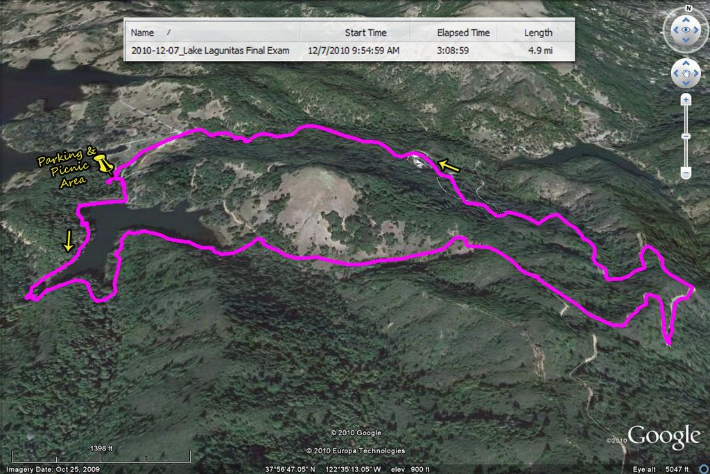
    Directions to trailhead:  Take Sir Francis Drake Boulevard into Fairfax. Jog left and make an immediate right in front of the movie theater. The first left puts you on Bolinas Avenue. Follow this until you see the sign on your left for Lake Bon Tempe and Lake Lagunitas. Follow the road to the toll booth by Sky Oaks Ranger Station. Park at the dirt parking lot on the right, just past the toll station.

    Click here for the MMWD map and directions. Or click here for a Google Maps map showing the trailhead location. Click on teardrop icon to get directions and driving time from your location.
     
    The day use fee is $8.  You can use a credit card, $1, $5, or $10 bills and coins at the automated pay station (change not given if you overpay).

    Annual watershed area parking passes for Marin residents are $60 ($30 for those 62 and older). You can buy them online or at the MMWD main office in Corte Madera.

    Time: 25 minutes from College of Marin. Portapotty in parking lot.  Carpoolers can meet at St. Rita's Church at 9:25 am.

    Weather forecast: As of Wednesday, November 23rd, the weather forecast for this hike was mostly sunny, with a high near 62. (Click here for an updated National Weather service forecast).

    More on this hike: Hike "C12 Taylor-Concrete Pipe-Bullfrog FR" in the Martins' book, Hiking Marin, shows the area where we will be hiking (our route may differ) in this part of the MMWD watershed.  (Click here to view and print the MMWD map of this area).

    This is one of the routes that we typically follow, although sometimes we've take a slightly different path during the final leg back to the parking lot.


    Here's the hike profile (which will vary slightly, depending on the exact route taken during the post-lunch section of the hike).


    Friday, November 17, 2017

    Bahia Open Space, Novato (11/21/2017)


    For our next hike we'll head north to the Novato area and do some birdwatching on a portion of the Marin County Open Space lands. (Click here for a recap of our 2009 hike. Click here for photos taken on past hikes in this area.)

    Here's Wendy's description of the outing: "This is a wonderful birding area! I'll bring a spotting scope, but bring binoculars if you have them. (If you don't have any, I have extras I can loan you.) We usually see about ten species of ducks, as well as stilts, avocets, grebes, raptors and shorebirds.”

    Directions to trailhead: Take Highway 101 and exit on Atherton Avenue in Novato. Go east, until Bugeia Lane splits left and Atherton goes right. Take Bugeia which becomes Bahia and park at the end of the street.

    (Click here for a Google Maps map showing the trailhead location. Click on the teardrop icon to get driving directions and estimated driving time from your location). 

    Driving time from College of Marin: 35 minutes. No restrooms at trailhead, but Dick Jordan suggests using one at Starbuck's in the Vintage Oaks Shopping Center just south of downtown Novato where you can also pick up beverages and food items if you need them.

    Carpoolers can meet at 9:20 a.m. at the Terra Linda Park & Ride lot on the east side of Highway 101 at the Smith Ranch Road exit. (Click here for a Google Maps map showing the Park & Ride location. Click on the teardrop icon to get, directions and estimated driving from your location.)
     
    Weather forecast: As of Friday, November 17th, the weather forecast for this hike was a chance of rain, mostly cloudy with a high near 67. (Click here for an updated National Weather Service forecast).

    More on this hike: Hiking in this particular areas isn't covered by any of the trail guides which Dick Jordan has, but you can click here for the Marin County Open Space District's description of the Rush Creek area.

    This map shows the route we generally follow.


    Here's the hike profile.


    Saturday, November 11, 2017

    Dipsea to Ben Johnson (11/14/2017)


    Having It Both Ways On the Hillside TrailThis week we head south in the County and back into the federal park lands.  Here's Wendy's description of the hike: "Instead of racing up the Dipsea, we’ll stop to admire ancient redwoods, beautiful views, and hopefully early mushrooms."  (Click here to read the recap of our 2/10/09 hike on these trails. You can view photos taken on previous hikes.)

    Directions to trailhead: From Highway 101 take the Stinson Beach exit, turn left (west) onto Shoreline Highway (Highway 1). At the junction with Loring Avenue, turn left again to continue on Shoreline Highway instead of heading into Mill Valley.

    Turn right onto Panoramic Highway and left onto Muir Woods Road. Meet at Muir Woods Parking Lot #2 (overflow parking).

    Click here for a Google Maps map that shows the location of the parking lot. Click on teardrop icon to get driving directions and time from your location.

    Time: 35 minutes from College of Marin. Restrooms at trailhead.

    Carpoolers can meet at the Greenbrae Parking & Ride lot at 9:00 a.m. (Click here for a Google Maps map showing the parking lot on Drakes Landing Road; click on the teardrop icon to get driving time and directions from your location.)

    Weather forecast: As of Wednesday, November 30th, the National Weather Service forecast for the hike was mostly sunny, with a high near 58. (Click here for an updated forecast).

    More on this hike: We'll hike up the Dipsea Trail, then descend back to the floor of Muir Woods on the Ben Johnson Trail. (Click here to view and download the park trail map).

    If you have Tracy Salcedo-Chourre's book, Exploring Point Reyes National Seashore and Golden Gate National Recreation Area, you'll see that she proposes hiking this route in the reverse direction (up the Ben Johnson, down the Dipsea) from our plan, but her book will at least give you an idea of what our hike will be like.

    This Google Earth image shows our route and distance.

    Here's the hike's elevation profile.

    Friday, November 3, 2017

    Indian Tree Open Space Hike (11/7/2107) Preview

    This week we head north and east to the Novato area to hike in the Indian Tree Open Space Preserve.
      
    Here's Wendy's hike description:  "We hike a pretty loop trail with views and a grove of old redwoods that escaped logging. If there has been rain you may want boots for this hike, or be prepared to rock hop a few streams." We have lunch in a redwood grove.

    (Click here to read the recap of our hike in this area on February 3, 2009. You can view photos from past hikes in this area by clicking here.)

    Directions:  Take Highway 101 north. Exit at DeLong Ave, which becomes Diablo Ave for a short stretch. Go west on Novato Blvd. Turn left (south) on Wilson Ave, right (west) on Vineyard Ave. The trail starts where the paved road turns into a dirt road, shown on this Google Maps map. (Click on the teardrop icon to get directions and driving time from your location.

    Time: 35 minutes from College of Marin. No restrooms at trailhead, but you could stop at Starbucks in the small shopping center at the intersection of San Marin Drive and San Andreas Drive, just before the Kaiser Permanente clinic.

    Carpoolers meet at 9:15 am at the Park & Ride lot on the east side of Highway 101 at Smith Ranch Road in the Terra Linda area north of the Marin Civic Center and downtown San Rafael.

    Weather forecast: As of Friday, November 3rd, the National Weather Service forecast for Tuesday's hike was partly sunny, with a high near 59. (Click here for an updated forecast).

    More on this hike: The Marin County Open Space District operates the preserve on a portion of this area (the North Marin Water District owns adjacent land) and its Web site provides a viewable/printable trail map.

    Barry Spitz's book, Open Spaces (Marin County Open Space District, 2000) describes the area and contains a map similar to that found on the MCOSD Web site.

    The "E9 Deer Camp - Big Trees Trails hike in the Martin's book, Hiking Marin, is much longer (7.2 miles) than the one we'll actually take, but shows the general area where we'll be hiking.

    Friday, October 27, 2017

    This loop features panoramic views of the Bay. You’ll appreciate the fact that it’s open space as you learn about Marincello, a city of 18,000 ( the exact number may vary depending on the source you consult about the history of the development) that was planned for this area! 

    We may see hawks like the Northern harrier, brush rabbits, and even a coyote. (Click here for a recap of a hike on 10/27/09). 
    Directions to trailhead:  Take the Stinson Beach exit from Highway101. Follow signs to Stinson Beach and Muir Woods, then turn left on Tennessee Valley Road and take it to the parking lot at the end.
    Time: 40 minutes from College of Marin. Carpoolers can meet at the Greenbrae Park & Ride lot between 9:00-9:15 am. Portables at trailhead. 
    One section can be very muddy, so waterproof your hiking boots if we’ve had any rain!  Hiking poles can be helpful, particularly on one steep downhill stretch of the trail.
    Weather forecast:  As of Friday, October 29, the National Weather Service forecast for the area of our hike is sunny with a high near 66.  (Click here for an updated forecast).
    More on this hike:  You won't find this hike described in either the Martins' book, Hiking Marin, or Tracy Salcedo-Chourre's Exploring Point Reyes Seashore and Golden Gate National Recreation Area.  Look instead at the GGNRA Marin Headlands trail map.  We'll head up the Marincello and Bobcat Trails, do a sharp turn and head down the Alta and Oakwood Valley Trails, then cross Tennessee Valley Road and walk west on the Rhubarb Trail until we get back to the parking lot.


    (Theresa Fisher created the following NPS map of the Golden Gate National Recreation Area overlaid with the route of our hike).

    Friday, October 20, 2017

    Fall 2 2017 Hike Schedule

    Fall 2 is a go!

    FALL 2  TUESDAYS INSTRUCTOR:  Wendy Dreskin TIME: 9:45 AM until 1:45 PM     
    WHAT TO BRING:  Water, lunch, warm layer, hat, sunscreen. Optional equipment: hiking poles, binoculars. Walks go rain or shine, so wear raingear when appropriate. State park pass or $8 cash for parking at East Peak. MMWD pass or credit card for parking at Lake Lagunitas.     

    OCTOBER 24 EAST PEAK, MOUNT TAMALPAIS STATE PARK      This lovely loop takes us by California torreya trees with their nutmeg-like nuts, past scenic Inspiration Point, to beautiful Collier Springs where we lunch under the redwoods. We’ll take Northside Trail to International Trail after lunch.     Take the Stinson Beach/Hway 1 exit off Hway 101. Go west through Tam Valley and up onto the ridge. Turn right onto Panoramic Hway and follow signs to Mt. Tamalpais.  Keep going up the Mountain, turn right at Rock Spring, and keep going until the road ends at the East Peak parking lot. Restrooms at trailhead. 1 hour from COM.   

    OCTOBER 31  TENNESSEE VALLEY, GGNRA This loop features panoramic views of the Bay. You’ll appreciate the fact that it’s open space as you learn about Marincello, a city of 18,000 that was planned for this area! We may see hawks like the Northern harrier, brush rabbits, and even a coyote.      Take the Stinson Beach exit from 101.  Follow signs to Stinson Beach and Muir Woods, then turn left on Tennessee Valley Road and take it to the parking lot at the end.      Time: 40 minutes from College of Marin. Portables at trailhead.      

    NOVEMBER 7  INDIAN TREE OPEN SPACE       We hike pretty loop  trail with views and a grove of old redwoods that escaped logging. If there has been rain you may want boots for this hike, or be prepared to rock hop a few streams.      Take 101 north.  Exit at DeLong Ave, which becomes Diablo Ave for a short stretch.  Go west on Novato Blvd.  Turn left (south) on Wilson Ave, right (west) on Vineyard Ave. The trail starts where the paved road turns into a dirt road.  35 minutes from College of Marin.                    

    NOVEMBER 14  DIPSEA TO BEN JOHNSON       Instead of racing up the Dipsea, we’ll stop to admire ancient redwoods, beautiful views, and - I hope! - early mushrooms!      From Hwy 101 take the Stinson Beach exit, turn left (west) on Shoreline Hwy, right on Panoramic Hwy and left on Muir Woods Rd. Meet at Muir Woods Parking Lot #2.               Time:  35 minutes from College of Marin. Restrooms at trailhead.      

    NOVEMBER 21 BAHIA OPEN SPACE, NOVATO       This is a wonderful birding area! I’ll bring a spotting scope, but bring binoculars if you have them.  (If you don’t have any, I have extras I can loan you.)  We usually see at least eight species of ducks, as well as swans, grebes, and shorebirds.      Take 101 and exit on Atherton Ave. in Novato. Go east, until Bugia splits left and Atherton goes right. Take Bugia, which becomes Bahia and park at the end of the street.      Driving time from College of Marin: 35 minutes. No restrooms.    

    NOVEMBER 28  SKY OAKS, MMWD      This loop starts out in oak/bay/madrone habitat, but we'll also see redwoods and some grassland.  This is a good mushroom hike with Boletes, Amanitas, Waxy Caps, Milky Caps and more if we've had some rain.        Take Sir Francis Drake Blvd. into Fairfax.  Turn left on Pacheco and make an immediate right in front of the movie theater which puts you on Broadway.  The first left puts you on Bolinas Ave.  Follow this until you see the sign on your left for Lake Bon Tempe and Lake Lagunitas. Follow the road to the tollbooth by Sky Oaks Ranger Station.  (Credit card accepted by the machine.)       Time: 25 minutes from College of Marin.    

    DECEMBER 5  FINAL EXAM LAKE LAGUNITAS, MMWD           We make a partial circle around the lake, looking for Ring-Neck Ducks, Mergansers, Grebes and other birds, and then make a loop past Pilot Knob, returning on Southern Marin Line. We usually see newts and some interesting mushrooms on this hike. Bring your contribution to our gourmet feast, plus a plate, utensils, and a cup.       As you enter Fairfax on Sir Francis Drake Blvd. jog left on Pacheco when you see the movie theater and make an immediate right.  This puts you on Broadway, the street that parallels SF Drake but is on the other side of the parkade. Make the first left which is Bolinas Ave. Follow the Bolinas-Fairfax Rd. for about 1 mile. Turn left onto Sky Oaks Rd. You'll need to pay at the kiosk. (Credit cards accepted.) Continue to the parking lot at the end of the road.      Driving time from College of Marin 30 minutes. Outhouse in parking lot.           
    ------------ 
    You received this e-mail because you are taking a class taught by Wendy Dreskin at College of Marin Community Education. College of Marin Community Education respects your privacy, and does not send unsolicited e-mails, nor do we rent or sell our mailing list to anyone.
    To ensure that future messages from us are delivered properly to your inbox (and not your bulk or junk mail folders), add bdreskin@comcast.net to your Address Book or Safe List.


    East Peak Mt. Tam Hike (10/24/17)

    FALL 2  TUESDAYS INSTRUCTOR:  Wendy Dreskin TIME: 9:45 AM until 1:45 PM     
    WHAT TO BRING:  Water, lunch, warm layer, hat, sunscreen. Optional equipment: hiking poles, binoculars. Walks go rain or shine, so wear raingear when appropriate. State park pass or $8 cash for parking at East Peak. MMWD pass or credit card for parking at Lake Lagunitas.     

    We have met the minimum (and reached the maximum, since both are 19) number of students so the class is a go.  I look forward to seeing everyone on Tuesday.

       Have a good weekend!
           Wendy 

    Mount TamThis week we hike in Mount Tamalpais State Park.

    This lovely loop takes us by California torreya trees with their nutmeg-like nuts, past scenic Inspiration Point, to beautiful Colier Spring where we lunch under the redwoods.

    We'll take Northside Trail to International Trail after lunch.


    (Click here for photos from past hikes.)

    Directions to trailhead:  Take the Stinson Beach/Highway 1 exit off Highway 101. Go west through Tam Valley and up onto the ridge.

    Turn right onto Panoramic Highway and follow signs to Mt. Tamalpais. Keep going up the mountain, and when you get to Pantoll at the crest of Panoramic Highway (beyond Bootjack, where our hike to the Mountain Theater begins), turn to the right and head uphill.

    When you top out on this road, turn right and keep going until the road ends at the East Peak parking lot. (Parking costs $8/day unless you have a park pass).  

    Click here for a Google Maps map that shows the East Peak Parking lot. Click on the teardrop icon to get driving times and directions from your location. 
      
    (Click here for a map of Mt. Tam that you can view and print out).

    1 hour from College of Marin.  Carpoolers can meet at the Greenbrae Parking & Ride lot at 8:55 am. Restrooms at trailhead. (Click here for a Google Maps map showing the parking lot on Drakes Landing Road; right click on the teardrop icon to get driving time and directions from your location.)

    Weather forecast: As of Tuesday, October 25th, the National Weather forecast for the hike was sunny with a high near 82. (Click here for an updated forecast).

    More on this hike:  Hike "B21 Northside - Colier – Lakeview Trails" in the Martins’ book, Hiking Marin, shows the trails we’ll be taking.  You can also view the trails on page five of the Mount Tamalpais State Park brochure.

    The following photo shows the route we'll take.


    This version shows the distance we'll hike.

    Here's the hike profile showing the elevation changes.

    Wednesday, October 11, 2017

    Rescheduled Final Hike -Tennessee Valley (10/17/17)

    The Colege of Marin canceled this hike because of poor air quality. Assuming that the air quality has improved, the hike is rescheduled for Tuesday October 17th.

    Per Wendy, "this loop [around Tennessee Valley] features panoramic views of the Bay. We often see Condominium spiders, several species of hawks, and sometimes find a bobcat hunting."

    REMEMBER TO BRING PLATE, UTENSILS, AND SOMETHING TO SHARE FOR THE GOURMET FINAL EXAM! (Let’s think green and try to cut down on paper and plastic throw-aways as much as possible). We’ll leave the food in the cars and eat when we get back, but bring your water bottle.

    (Click here for a recap of our October 2008 hike. Here's an album of photos from past hikes in this area.).

    Directions to trailhead: Take the Stinson Beach exit from Highway 101. Follow signs to Stinson Beach and Muir Woods, then turn left on Tennessee Valley Road and take it to the parking lot at the end.

    (Click here for a Google Maps map showing the trailhead. Click on the teardrop icon to get driving time and directions from your location.)

    40 minutes from College of Marin.

    Carpoolers can meet at the Greenbrae Park & Ride lot 9:15 am. (Click here for a Google Maps map showing the parking lot on Drakes Landing Road; right click on the teardrop icon to get driving time and directions from your location.)

    Portable toilets at the trailhead and lunch.

    Weather forecast: As of Saturday, October 7th, the National Weather Service forecast for the hike was sunny, with a high near 72.  (Click here for an updated forecast)..

    More information on this hike: Hike A8 Miwok – Coyote Ridge – Coastal Trails in the Martin's book, Hiking Marin, shows our route from Tennessee Valley towards Mill Valley, westward to ocean views, then back east to the parking lot.

    Here's the route we'll follow.


    Here's the hike profile.