Tuesday, October 25, 2016

East Peak Mt. Tam Hike (11/1) Preview

Mount Tam This week we hike in Mount Tamalpais State Park.

This lovely loop takes us by California torreya trees with their nutmeg-like nuts, past scenic Inspiration Point, to beautiful Colier Spring where we lunch under the redwoods.

We'll take Northside Trail to International Trail after lunch.


(Click here for photos from past hikes.)

Directions to trailhead:  Take the Stinson Beach/Highway 1 exit off Highway 101. Go west through Tam Valley and up onto the ridge.

Turn right onto Panoramic Highway and follow signs to Mt. Tamalpais. Keep going up the mountain, and when you get to Pantoll at the crest of Panoramic Highway (beyond Bootjack, where our hike to the Mountain Theater begins), turn to the right and head uphill.

When you top out on this road, turn right and keep going until the road ends at the East Peak parking lot. (Parking costs $8/day unless you have a park pass).  

Click here for a Google Maps map that shows the East Peak Parking lot. Click on the teardrop icon to get driving times and directions from your location.
  
(Click here for a map of Mt. Tam that you can view and print out).

1 hour from College of Marin.  Carpoolers can meet at the Greenbrae Parking & Ride lot at 8:55 am. Restrooms at trailhead. (Click here for a Google Maps map showing the parking lot on Drakes Landing Road; right click on the teardrop icon to get driving time and directions from your location.)

Weather forecast: As of Tuesday, October 25th, the National Weather forecast for the hike was a chance of rain. Mostly cloudy, with a high near 61. (Click here for an updated forecast).

More on this hike:  Hike "B21 Northside - Colier – Lakeview Trails" in the Martins’ book, Hiking Marin, shows the trails we’ll be taking.  You can also view and the trails on page five of the Mount Tamalpais State Park brochure.

The following photo shows the route we'll take.


This version shows the distance we'll hike.

Here's the hike profile showing the elevation changes.

Wednesday, October 19, 2016

NO HIKE - TUESDAY, OCTOBER 25TH

Just a quick reminder that there is no hike on Tuesday, October 25th.


The Fall 2 sessions of College of Marin Meandering on Tuesday hikes will kick off at East Peak on Mountain Tamalpais State Park on November 1st.

Tuesday, October 18, 2016

Let Them Eat Cake!

What should Meanderers do after a warm uphill and downhill hike above Tennessee Valley?


Dick Jordan says, "Let them eat cake!"

If you missed today's hike and "Final Exam" luncheon you missed two announcements by Dick:
  1. He's now much "Older Than Dirt"!
  2. In mid-January he'll probably have moved from Marin to Eugene, Oregon.
In the meantime, he'll keep posting to the Meandering in Marin blog and, who knows, maybe next year you'll mosey up Highway 101 or I-5 to go meandering with him along the Oregon coast or the Cascade Mountains, both of which will only be about an hour away from his new home.


Friday, October 14, 2016

Tennessee Valley "Final Exam" Hike (10/18) Preview

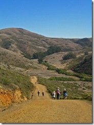
Down In The Valley Per Wendy, "this loop [around Tennessee Valley] features panoramic views of the Bay. We often see Condominium spiders, several species of hawks, and sometimes find a bobcat hunting."

REMEMBER TO BRING PLATE, UTENSILS, AND SOMETHING TO SHARE FOR THE GOURMET FINAL EXAM! (Let’s think green and try to cut down on paper and plastic throw-aways as much as possible). We’ll leave the food in the cars and eat when we get back, but bring your water bottle. 

(Click here for a recap of our October 2008 hike. Here's an album of photos from past hikes in this area.).

Directions to trailhead: Take the Stinson Beach exit from Highway 101. Follow signs to Stinson Beach and Muir Woods, then turn left on Tennessee Valley Road and take it to the parking lot at the end.

(Click here for a Google Maps map showing the trailhead. Click on the teardrop icon to get driving time and directions from your location.)

40 minutes from College of Marin.

Carpoolers can meet at the Greenbrae Park & Ride lot 9:15 am. (Click here for a Google Maps map showing the parking lot on Drakes Landing Road; right click on the teardrop icon to get driving time and directions from your location.)

Portable toilets at the trailhead and lunch.

Weather forecast: As of Friday, October 14th, the National Weather Service forecast for the hike was mostly sunny, with a high near 69.  (Click here for an updated forecast)..

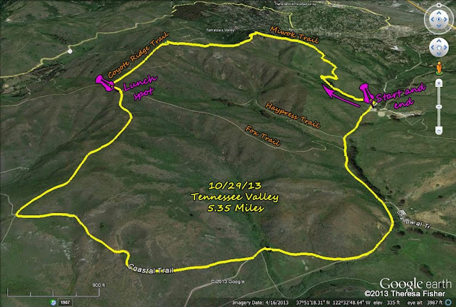
More information on this hike: Hike A8 Miwok – Coyote Ridge – Coastal Trails in the Martin's book, Hiking Marin, shows our route from Tennessee Valley towards Mill Valley, westward to ocean views, then back east to the parking lot.

Here's the route we'll follow.


Here's the hike profile.

Tuesday, October 4, 2016

Mountain Home to Bootjack (10/11) Hike Preview

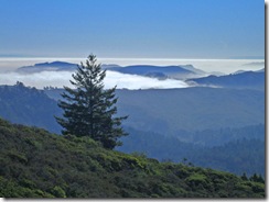
Sun Above, Fog Below This week we head south in Marin for a trek up and down trails on Mount Tamalpais.
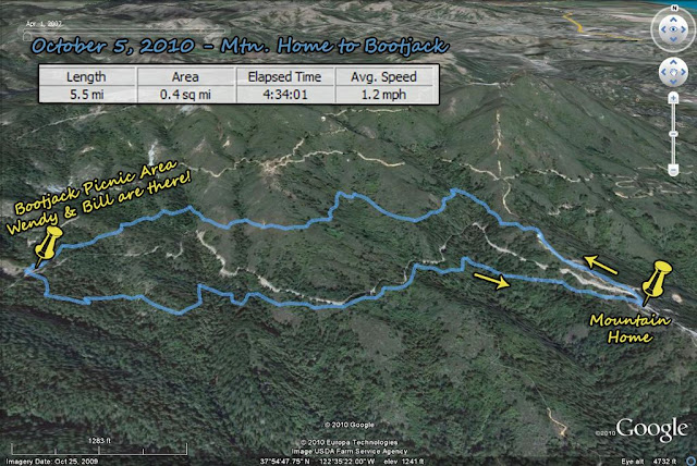
Per Wendy, "this hike takes us through redwood forest, over Fern Creek, into chaparral, and finally to lunch at Bootjack. The return is fairly level and shady."  (Click here for a recap of our October 2008 hike and click here for the photo album for this hike.)

Directions to trailhead: Take the Stinson Beach/Highway 1 exit off Highway 101. Go west through Tam Valley and up onto the ridge. Turn right onto Panoramic Highway and follow signs to Mt. Tamalpais. Drive about 4 miles.

When you reach Mountain Home Inn on your right, park in the parking lot across the road on your left.

50 minutes from College of Marin.

Carpoolers can meet at the Greenbrae Park & Ride lot at 9:00 am.

Click here for a Google Maps map showing the Mountain Home Inn. Click on the teardrop icon for directions and driving time from your location.

Restrooms at trailhead and Bootjack.

Weather forecast: As of Tuesday, October 4th, the National Weather Service forecast for the hike was mostly sunny, with a high near 68. (Click here for an updated forecast.)

More on this hike:  Hike "B9 – Matt Davis – Troop 80 Trails" – in the Martin's book, Hiking Marin, shows the area where we’ll be hiking.

This Google Earth view of Mt. Tam shows the trails that we'll be following.


Here's the hike profile.